
很抱歉,没有找到 “” 相关结果
请修改或者尝试其他搜索词
设计单位 普罗建筑+也似建筑+深圳建筑科学研究院
项目位置 广东深圳
方案状态 入围方案
用地面积 45268平方米
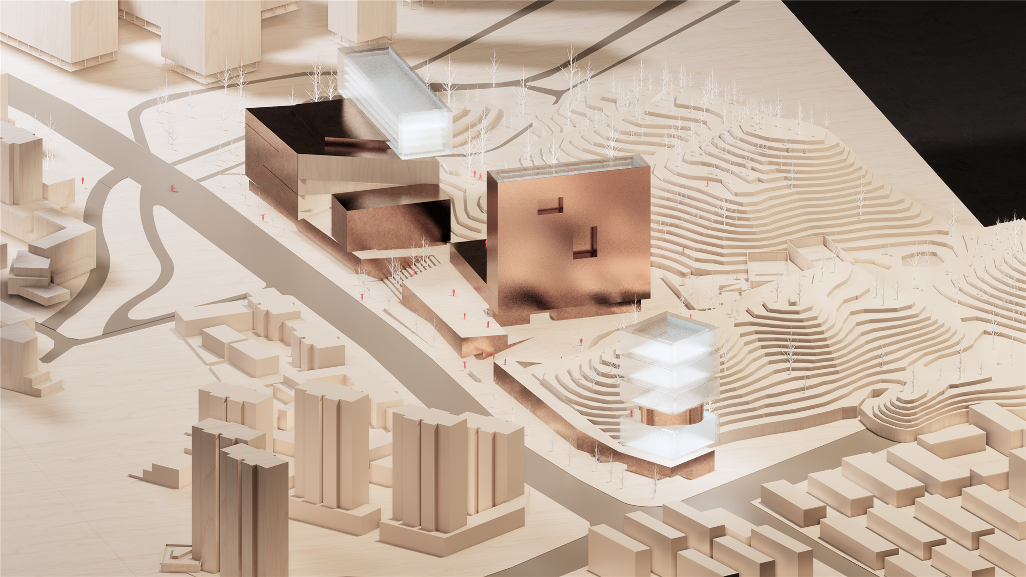
垂直灯塔、漂浮方舟、螺旋引擎,它们代表了一种现实的畅想——即在社会与自然、机构与个体之间,可以做到协作发展。
▲ 视频介绍 ©IBR_OfficeProject_YES.arch
城与山间
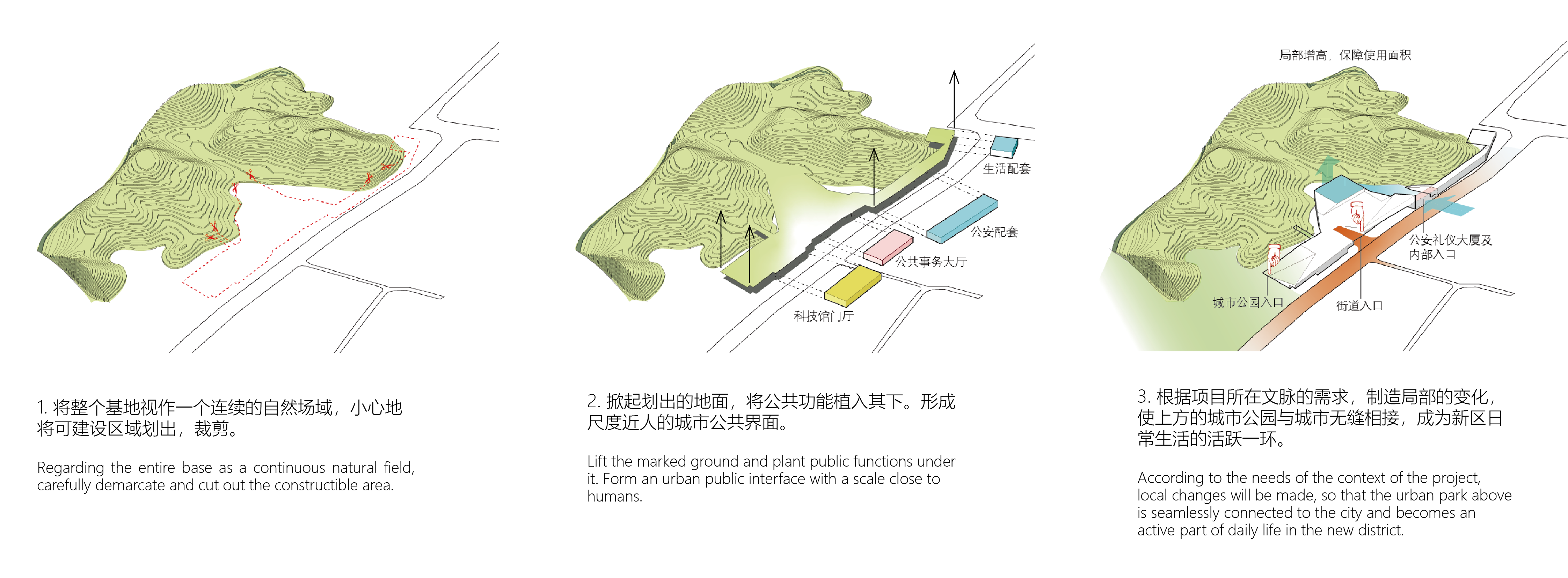
总体规划策略
—
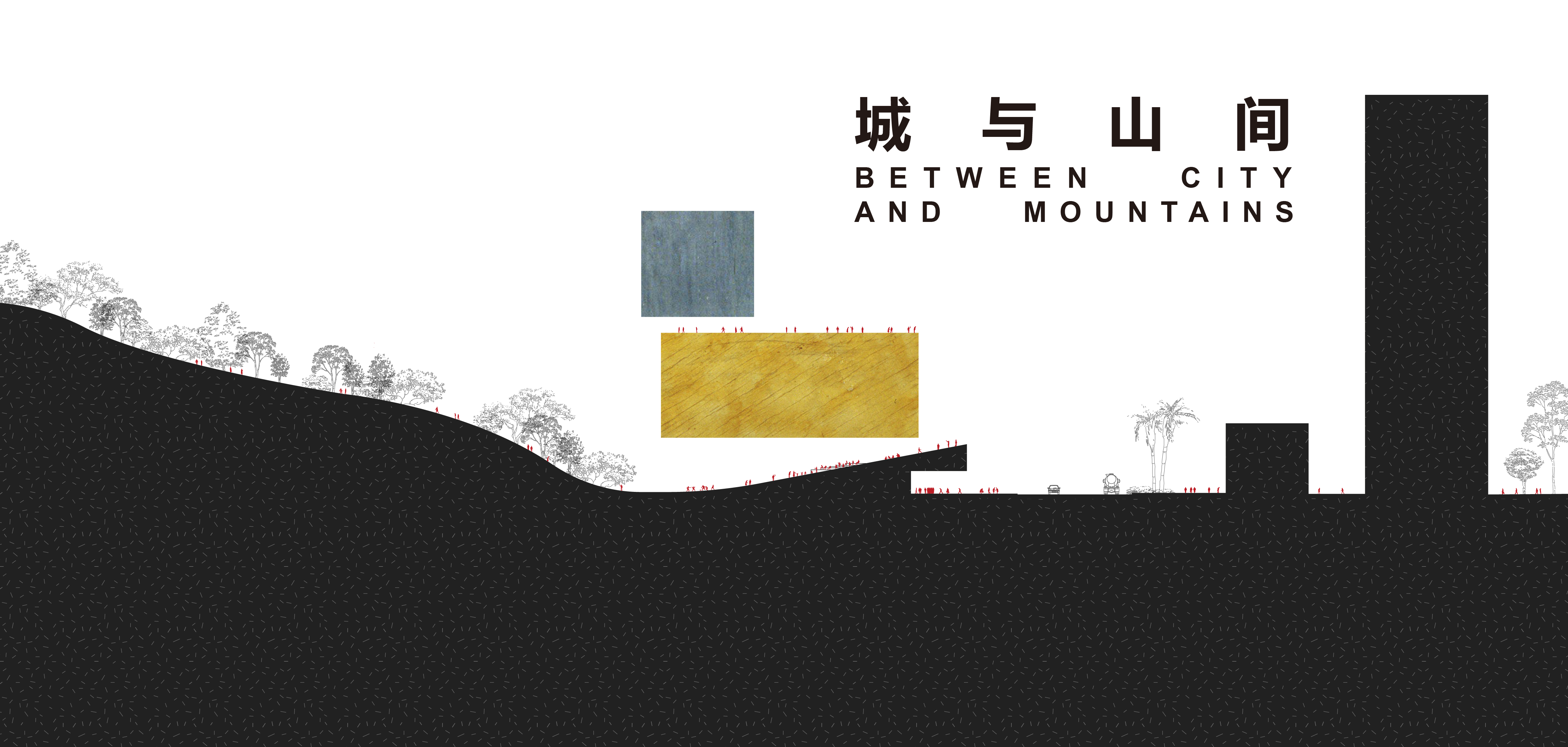
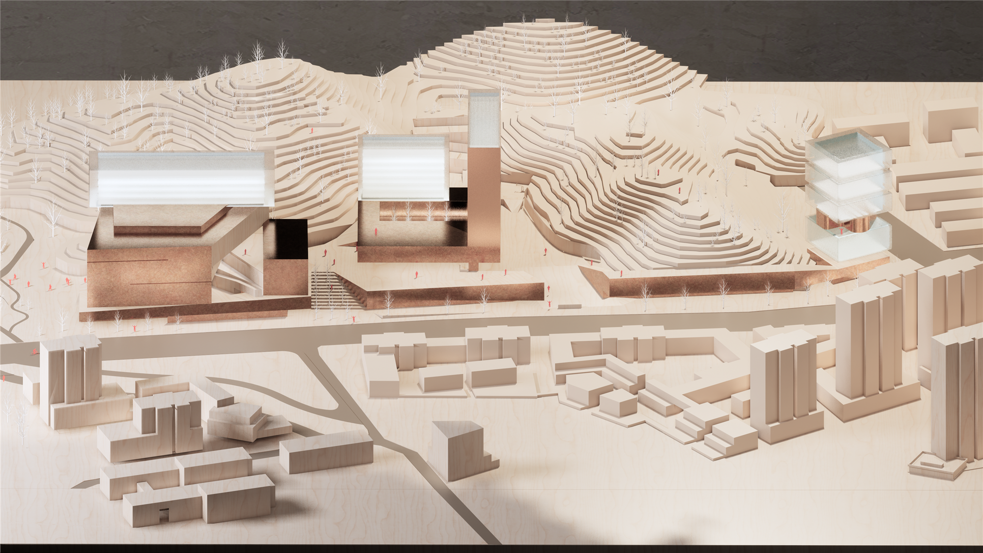
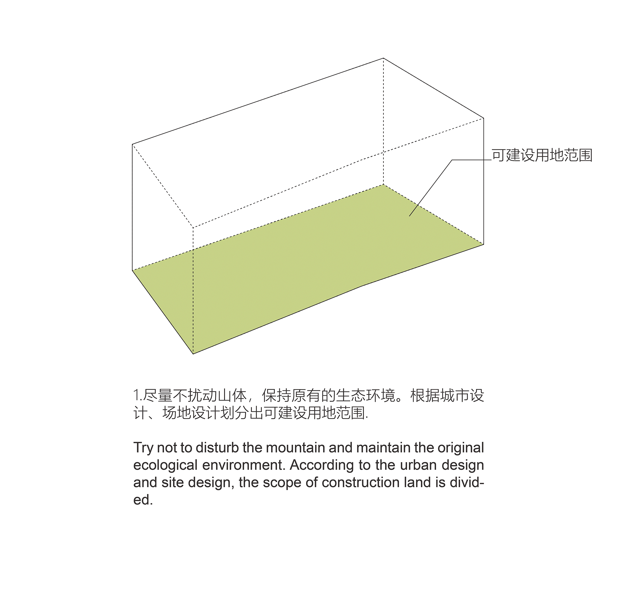
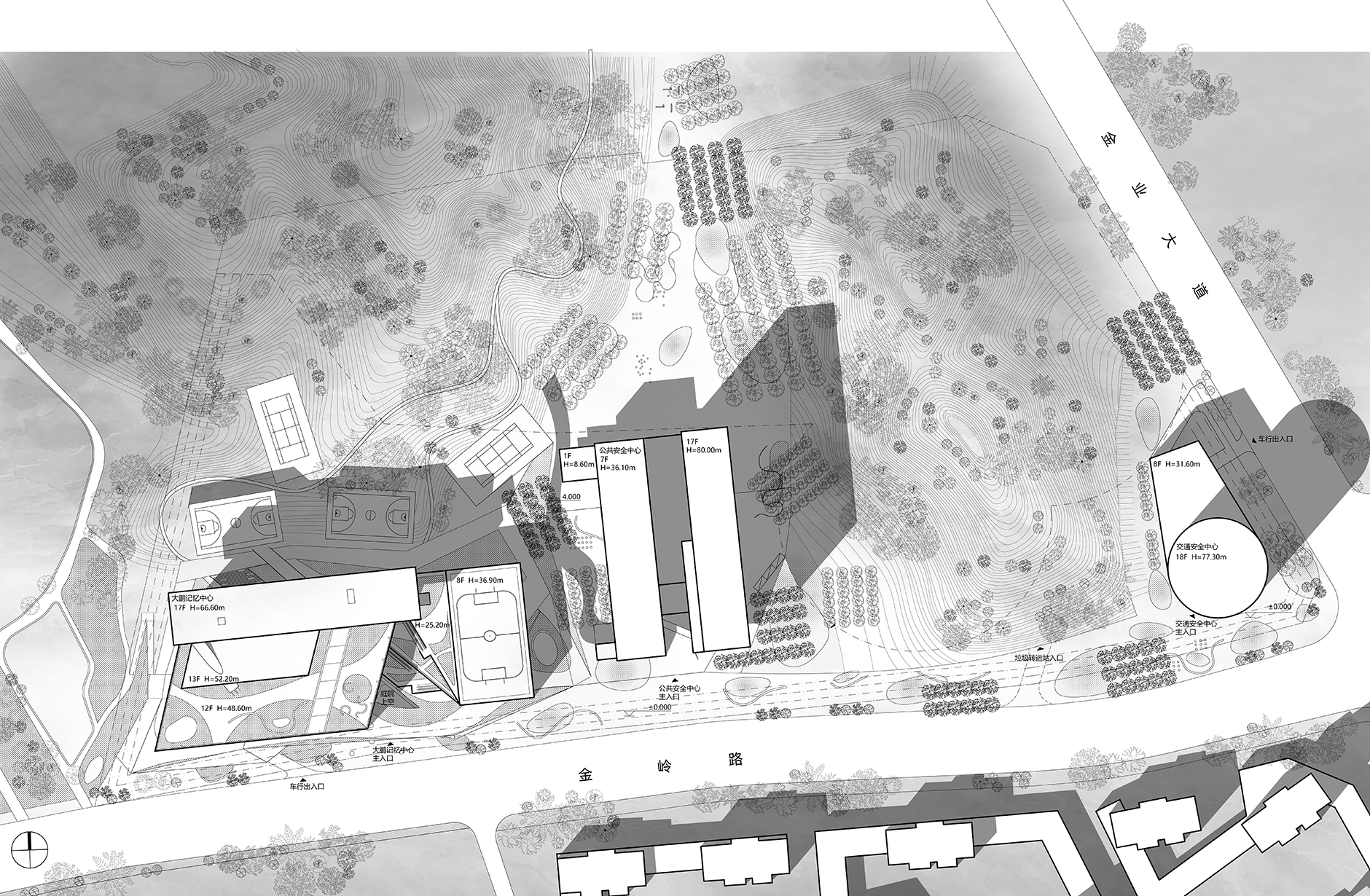
项目位于深圳市大鹏新区葵涌中心区,基地被笔架山余脉深深地包围与渗透,正如大鹏新区葵涌中心被群山环绕的地形特征一样。整个基地是笔架山麓的延伸,又是以金岭路为最北侧干道的城市空间边缘。这注定了未来的大鹏公共事务中心建筑群必须回应“山”与“城”的敏感关系,并成为探讨城市与自然互为表里关系的模型。未来的建筑应该尽最大可能保留山体原貌,与自然保持和谐的关系。
The site is located in Kwai Chung Central District, Dapeng New District, Shenzhen city,which is deeply surrounded by Bijia Mountain, which had the same topographic features as Kwai Chung Center in Dapeng New Area. The whole site is located in the stretch of Bijia Mountain and at the edge of the urban space besides Jinling Road,which is the northernmost road in the site. Both characters set the future of Dapeng Public Affairs Center should respond the strong relationship between "mountain" and "city", thus become an experimental model to explore the interactions between city and nature.

大鹏公共事务中心位于自然山体与城市之间,如何将大体量建筑布置于此,并保持自然与城市渗透融合,是设计出发的原点:
Dapeng Public Affairs Center is located between the natural mountain and the city. How to arrange the massive building here and maintain the infiltration and integration of nature and the city is the origin of the design:
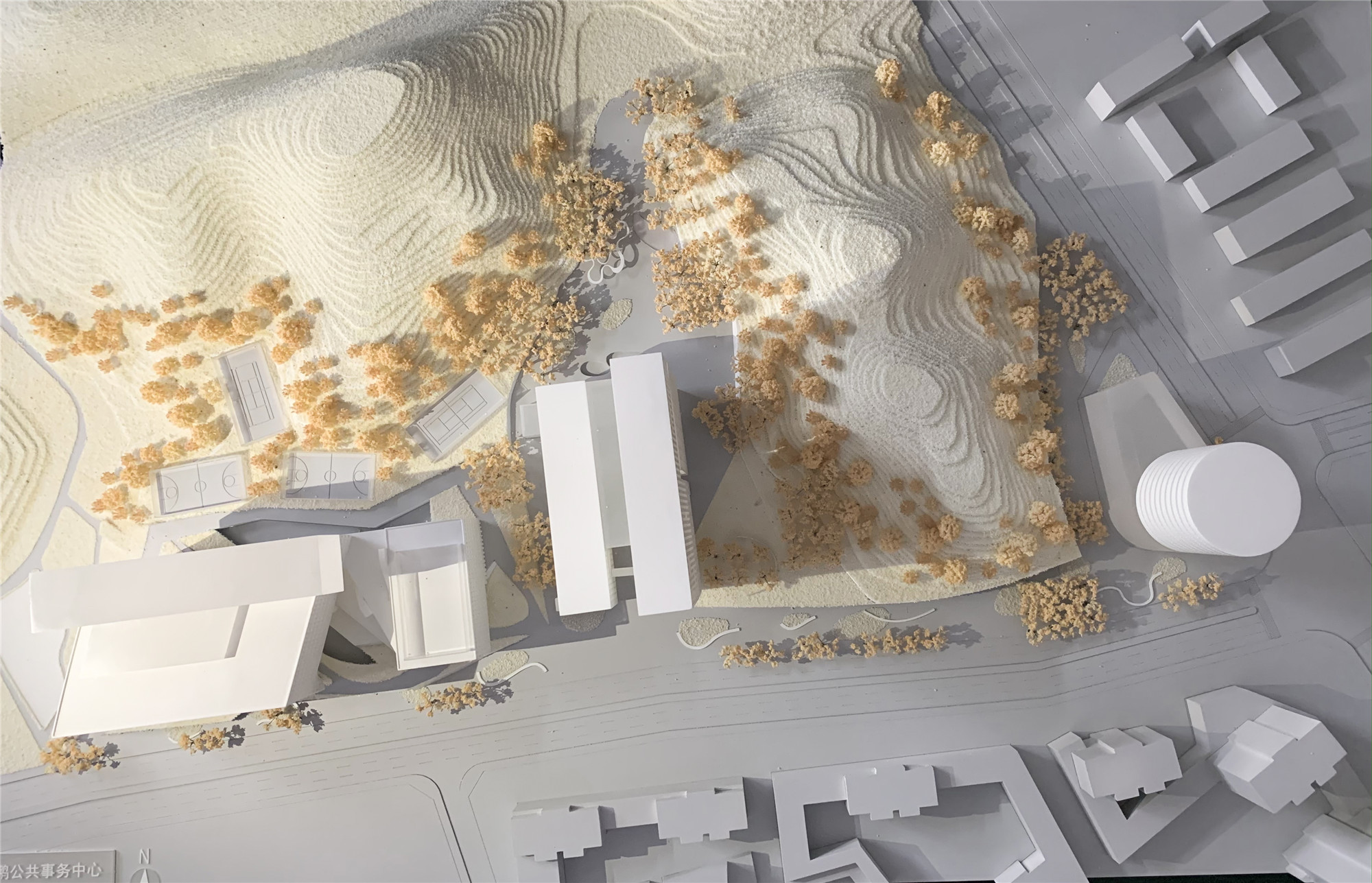
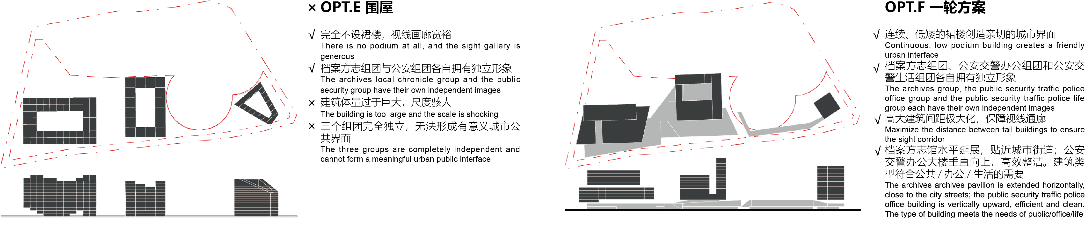
1. 在平面组织上,考虑到对山体原貌的保留,避免城市界面视觉上过大的建筑体量,以及南侧界面的开放性程度的不同等诸多原因,经过多种布局研究,三个独立而集中的建筑体成为最优解。整个场地的景观将通过这种散点式的建筑布局自然地组织与生长。
1. In terms of master plan organization, considering the protection of the mountain, the avoidance of excessive building volume, and the different degree of openness of the south interface; after a variety of layout studies, three independent and concentrated building bodies become the optimal solution. The landscape of the whole site will be organized and grown naturally through this scattered architectural layout.
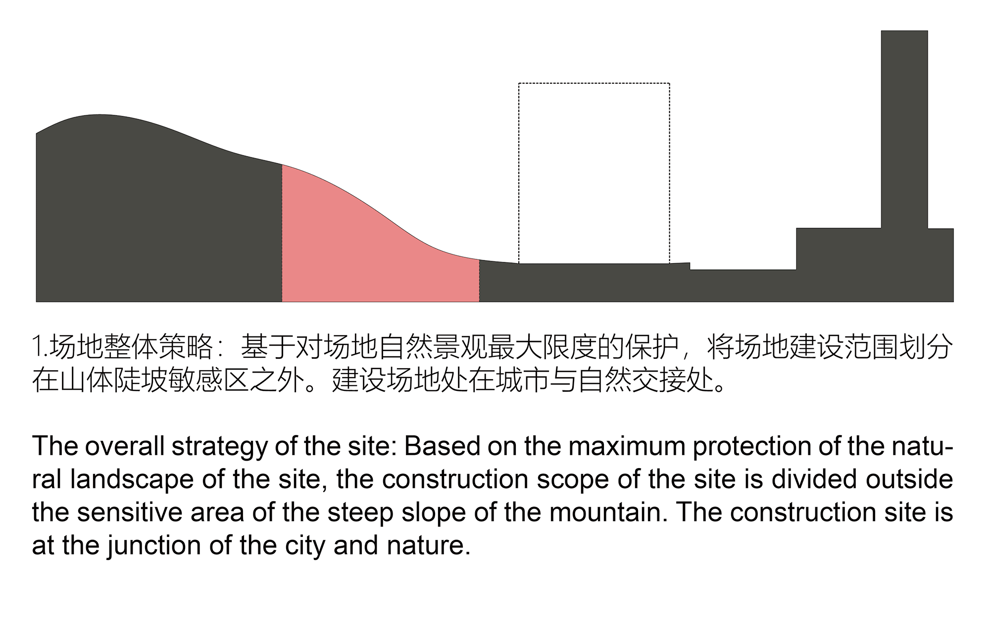
项目基地内地形情况多元。两座南北走向、高出街道约40米的笔架山余脉决定性地将基地划分为四个部分:“西山”、“山谷”、“东山”、基地东南角的“三角地”;其中“西山”和“东山”在朝向城市的一侧均为敏感的陡坡带,改造难度大。未来的建筑应该尽最大可能保留山体原貌,与自然保持和谐的关系。
The topographic conditions on site are diverse. The two lines of mountains that appears from north to south in Bijia Mountain, which approximately 40-meter higher above the street, divide the site into four parts: "West Hill", "Valley", "East Hill", and "Triangle Area". The“Triangle Area” is in the southeast corner of the whole site. The” West Hill” and the “East Hill” are all steep slops to the city, which are difficult to be reconstructed. Our design should try the best to preserve the original appearance of the mountain and maintain a harmonious relationship with nature and city. The earthwork excavation should also be balanced in the site, and as far as possible to solve problems like flood discharge and landslides by the topography.


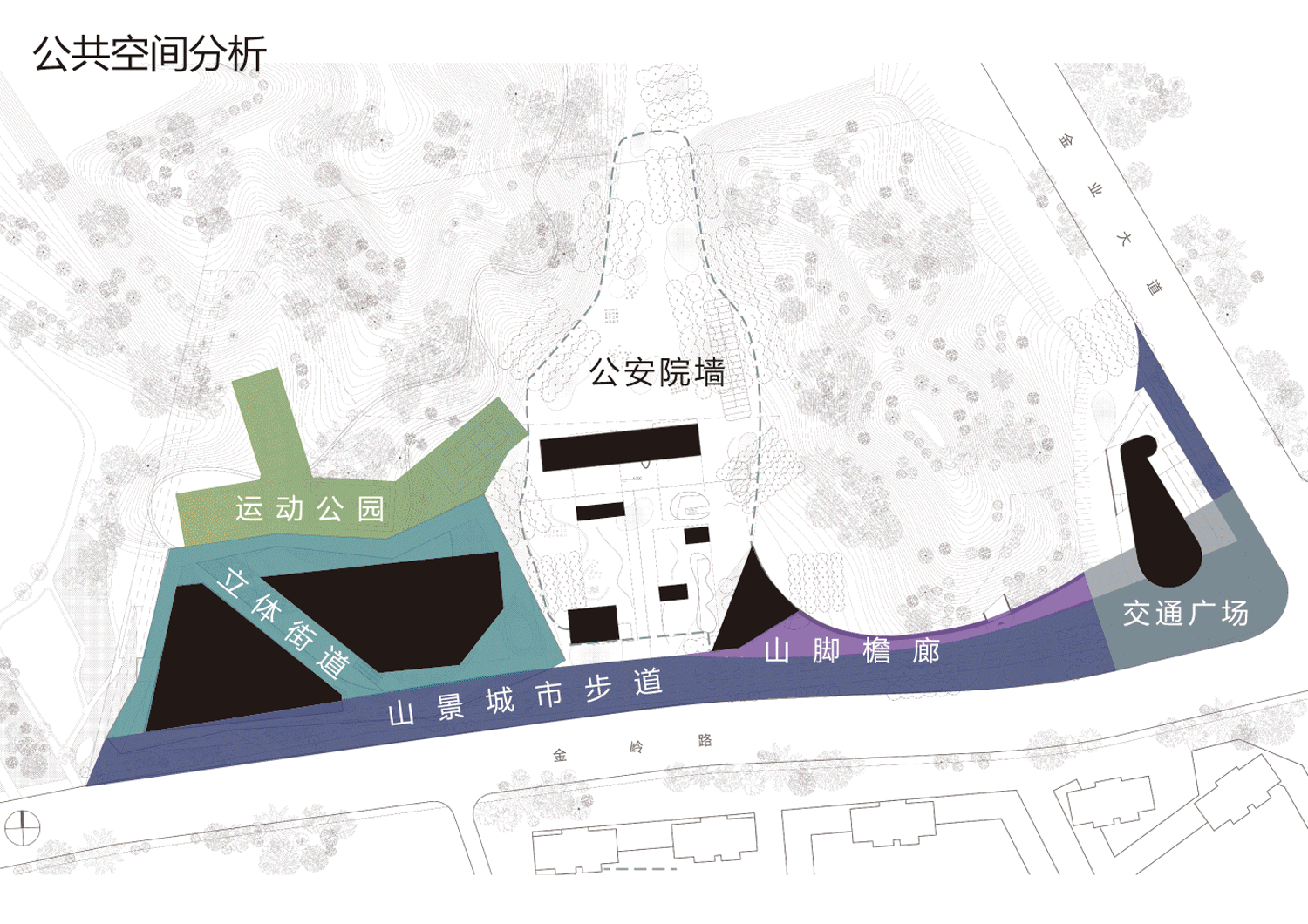
金岭路将大鹏新区管委会及葵涌街道文化广场、禾塘山水公园、大鹏公共事务中心等市民公共服务机构和设施串联起来,形成一个东西走向的“城市公共走廊”;因此基地的南侧边界有着重要的城市意义,设计必须以一个“公共”的姿态作为回应,而避免形成传统行政建筑“高墙大院”的形象。
Jinling Road will be the starting point of the future north-south axis of an east-west "urban public corridor" links the Dapeng New District Management Committee, Kwai Chung Street Cultural Square, Hetang Landscape Park, Dapeng Public Affairs Center and other public service institutions and facilities. The Dapeng Public Affairs Center will become a focus of this corridor and its southern boundary and building’s elevation have important urban significance. The design should own a public posture to embrace nature and avoid becoming a boring one as a "high-walled compound" public affair center.
基地东侧的金业大道是贯穿整个新区南北的机动交通动脉,必将是区域内快速交通的负担者;且沿路东侧均为工业设施,功能相对单一,与基地西侧以禾塘山水公园为中心的丰富市民空间形成强烈对比。这决定了建筑群的公共性是由东向西递增:与禾塘山水公园相接的场地西南角公共性最高,而金业大道与金岭路口公共性低。
Jinye Avenue is a motorized traffic artery running through the whole new district from north to south, undertaking the rapid traffic in the region. Besides, along the east side of the road are all industrial facilities, different from the west side buildings. The sharp contrast from the boring industrial buildings to the rich civic public space in Hetang Landscape Park o, determines that the sense of public and culture is increasing from east to west: the southwest corner of the site, which linked to Hetang Landscape Park, has the highest public phenomena, while the Jinye Avenue and Jinling intersection has the lowest public genes.

2. 在立体维度,通过将建筑体抬升,使“山”从建筑底部蔓延到城市,建筑将变成山城之间的融合物。
2. In the three-dimensional dimension, by elevating the building body, the "mountain" spreads from the bottom of the building to the city, and the building becomes a fusion between the mountain and the city.

整个基地内适宜建设范围(排除掉敏感的陡坡区域和亟需小心保育的原始地貌)仅有1.7万平方米,而地上建筑面积则达到了11万平方米。由于可建设范围基本是一条东西走向的狭长地带,缺乏足够建筑群落散开的进深,建筑即使将所有建设范围铺满,只能得到一个四十多米高、紧贴城市街道、密不透风的两百米长的巨物。
The site's suitable construction area (excluding steep slopes and natural preservation zone) is only 17, 000 square meters. However, the above-ground floor area is required 110, 000 square meters. Due to suitable construction area is a narrow strip area from east to west, buildings cannot be built into double rows. The long-strip buildings would become a forty-meter high, closed to the city streets, two-hundred-meter-long monster.
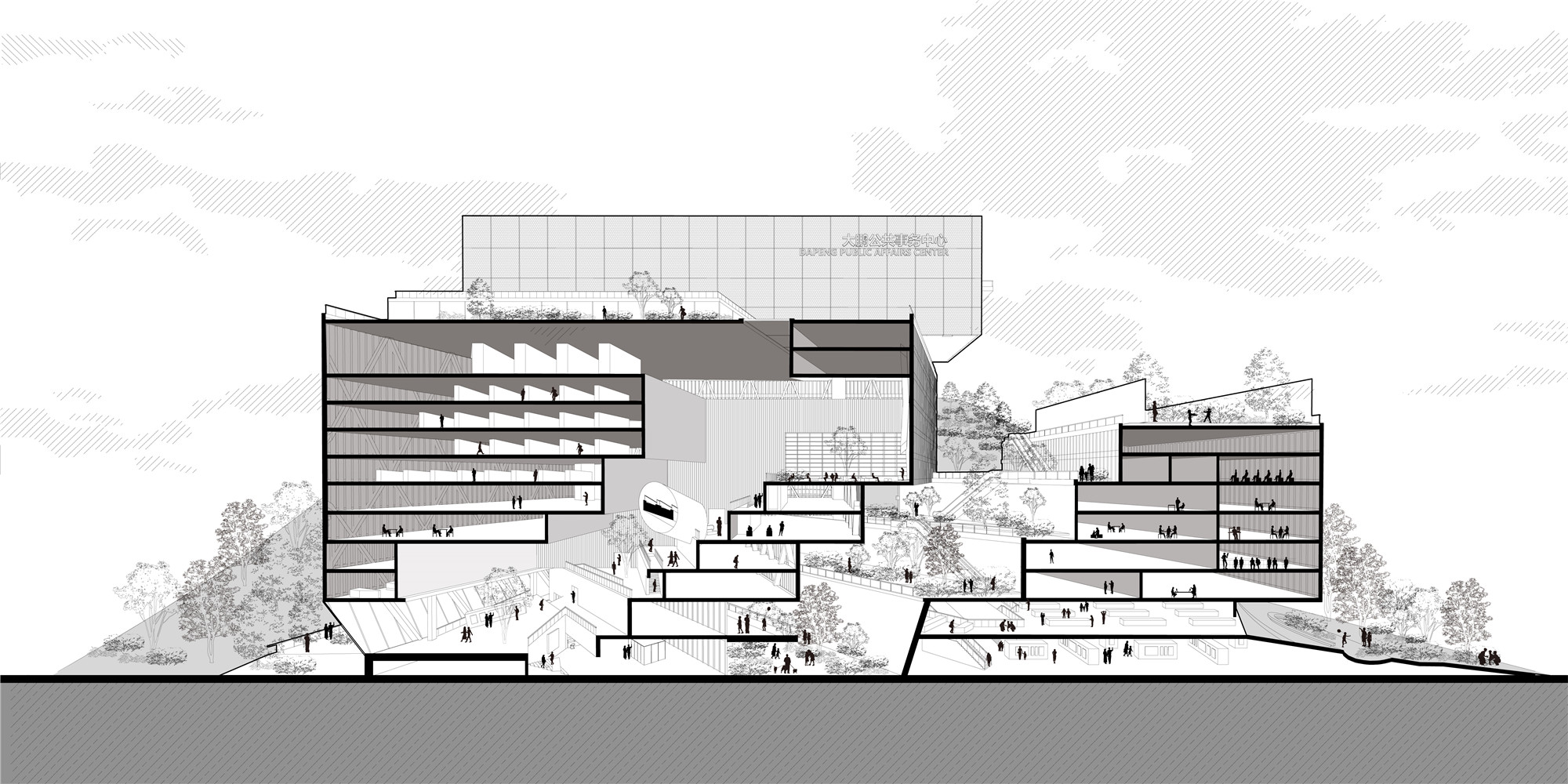
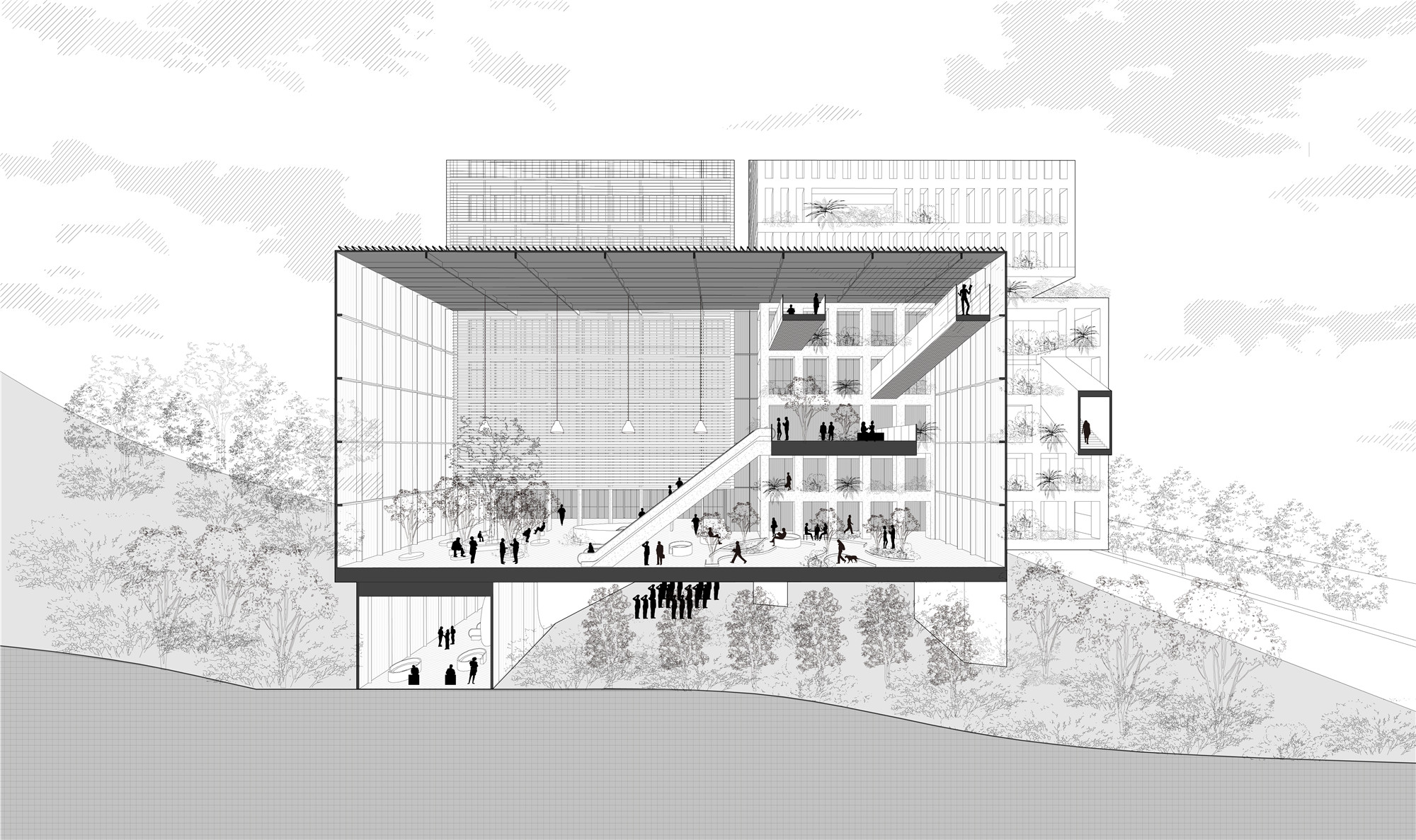
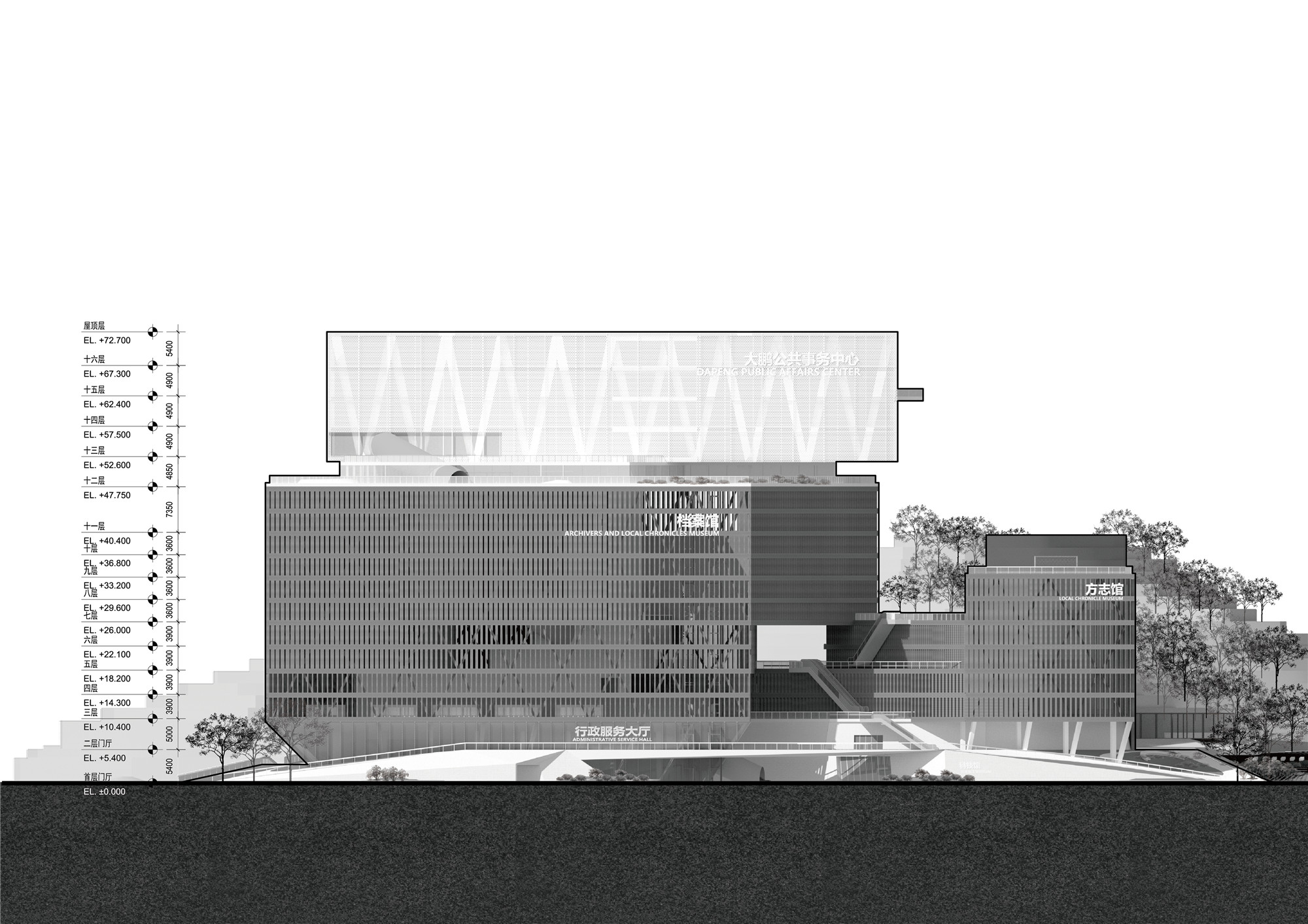
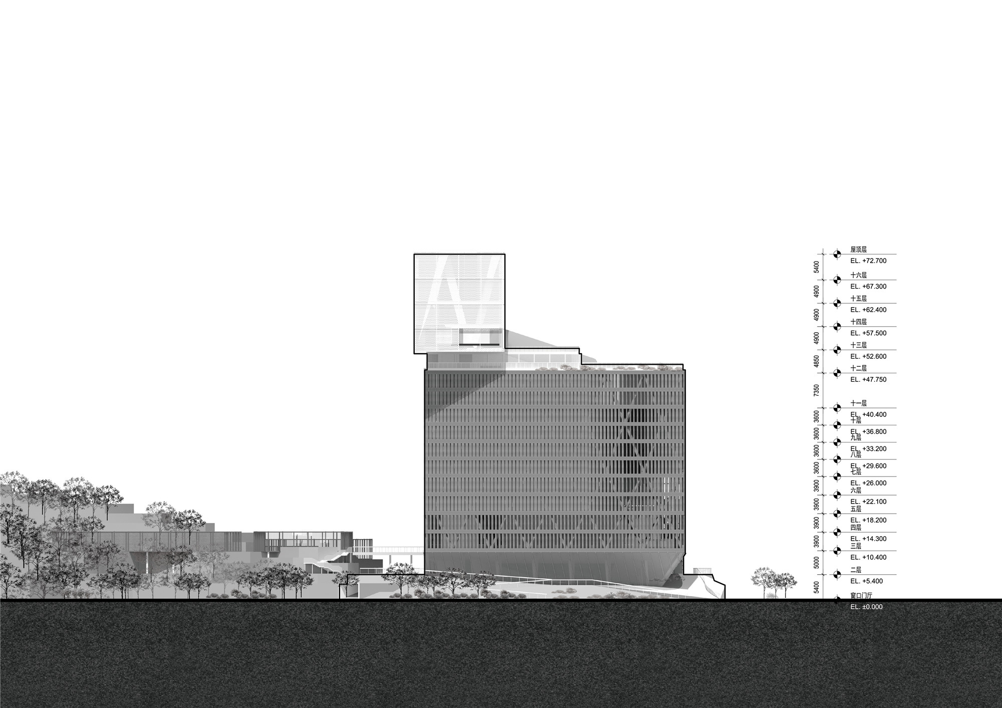
作为应对,设计师在垂直方向上将整个建筑群分为两个部分:下部是不超过三层楼高度、尺度亲人、功能多元而具备统一性的“城市公共群落”;上部是利用建筑最大限高将面积极大化、悬浮、各自独立、使用高效的“建筑功能群落”。整个规划将建筑群落与复杂的山体连接成一个可供市民漫步的整体,在尊重双方的前提下、模糊了“山”与“城”的边界。大鹏公共事务中心既是山下之城,也是城中之山。
We split our building groups vertically into 2 parts as the solution: the lower part is controlled in three stories as the urban public community groups which is pluralistic function and scales, and the upper part is a group of floating” function boxes” which is a relatively independent but efficient usable space. The whole plan connects the building ‘s community with the complex mountain topography into a whole body and forms a citizens' wandering path. The design blurs the boundary between "mountain" and "city", interacting and respecting each other. The Dapeng Public Affairs Center is not only the city under the mountain, but also the mountain in the city.
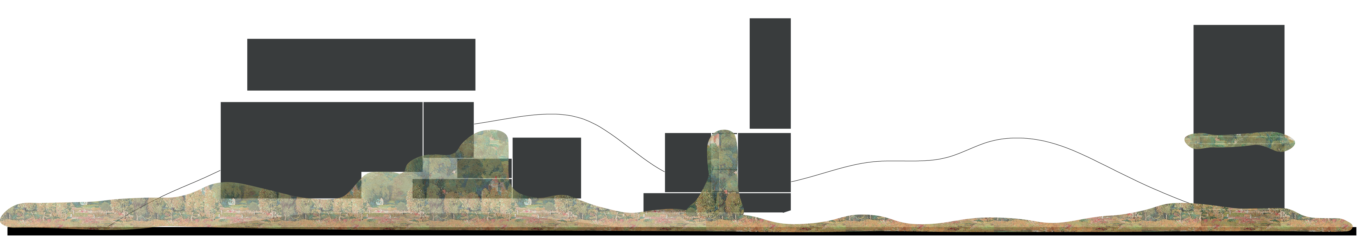
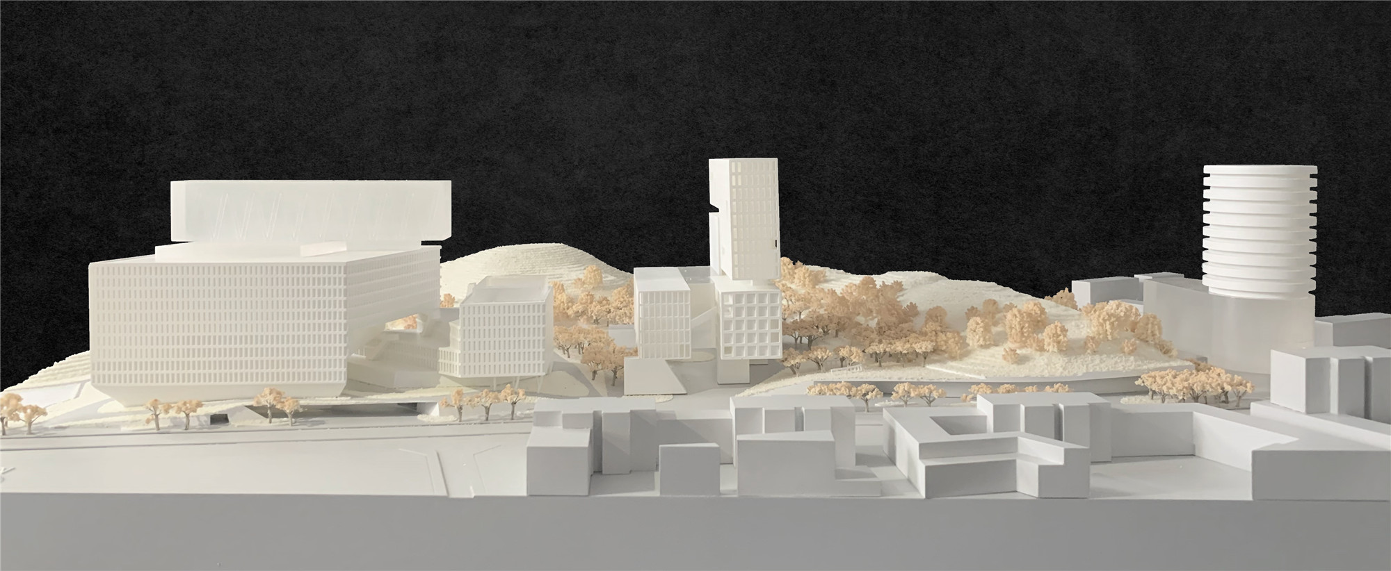
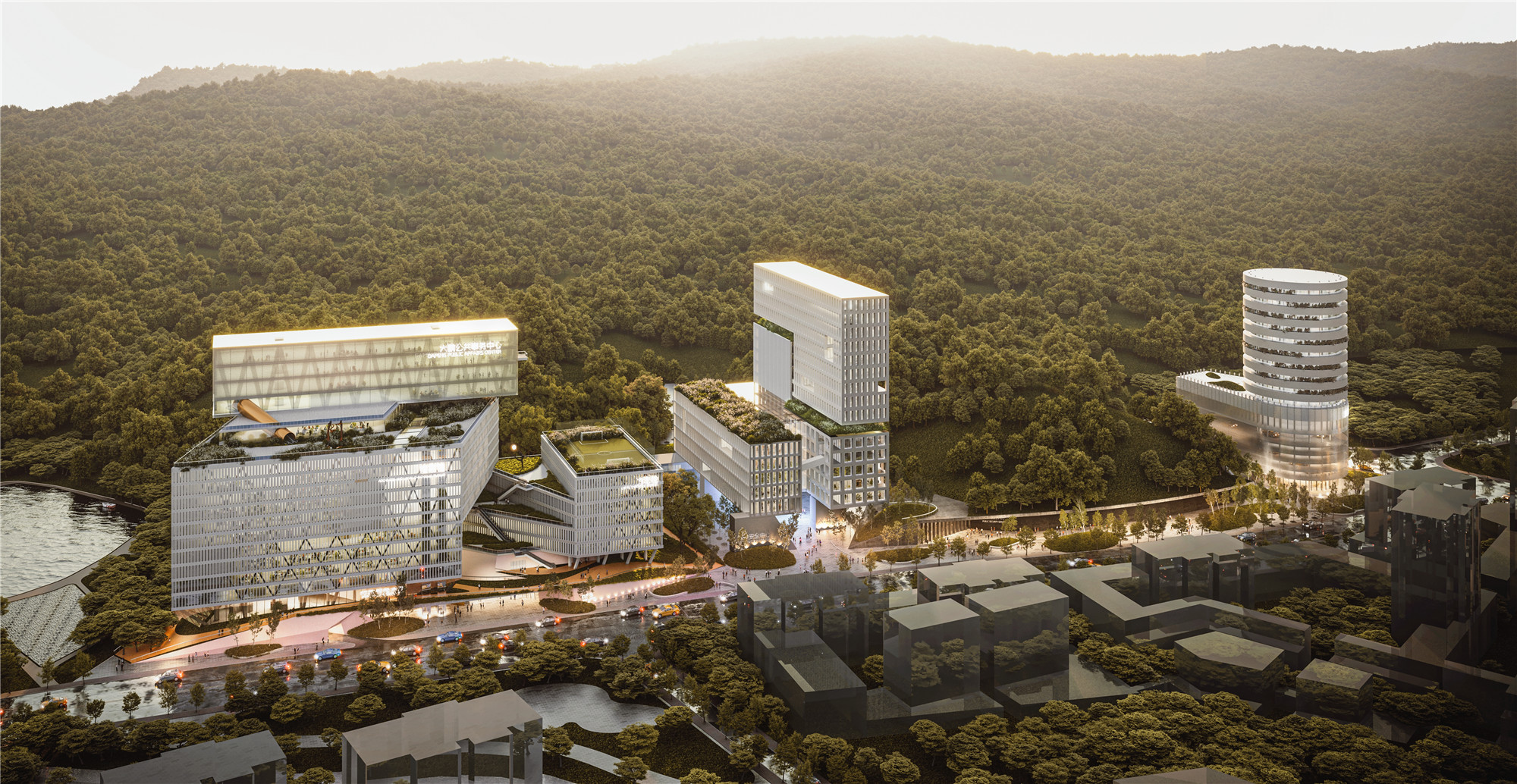
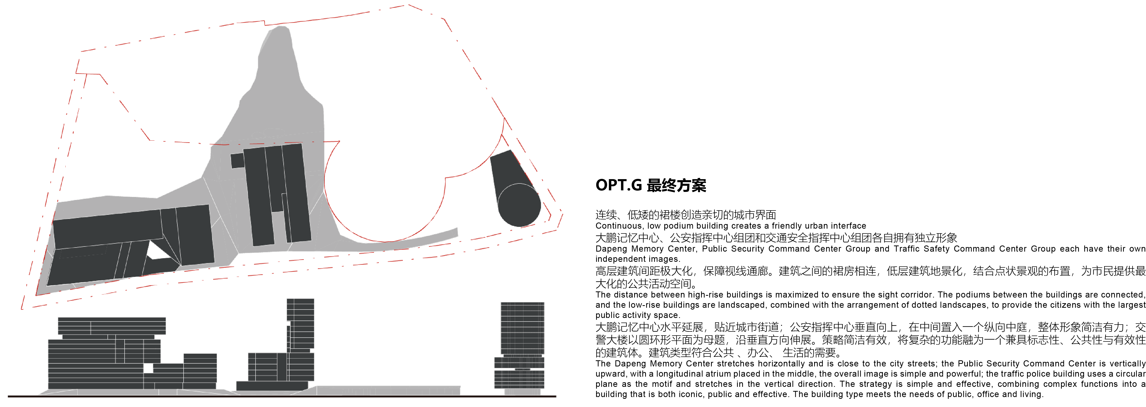
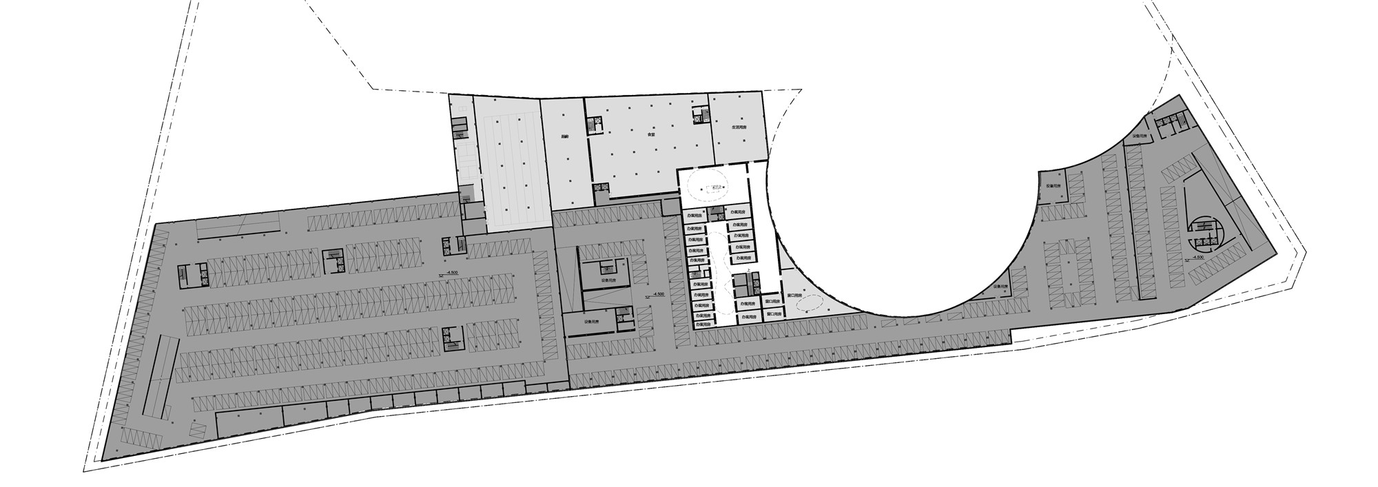
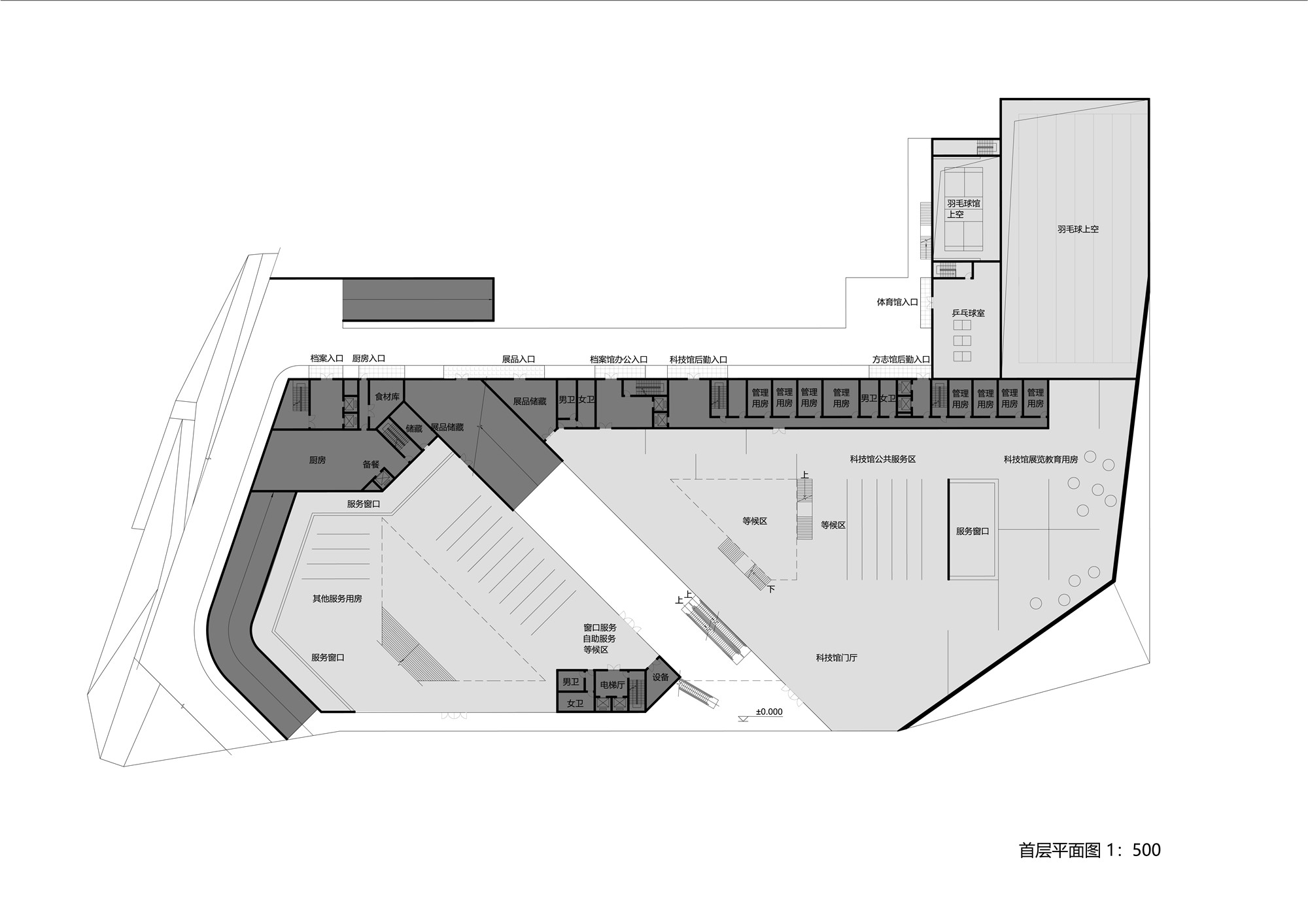
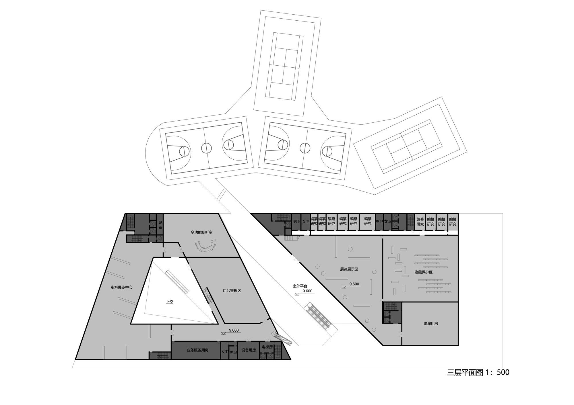
建筑功能群落由三大中心组成:占据基地公共性最强的西南角的,容纳档案馆、方志馆与科技馆的“大鹏记忆中心”;坐镇基地中央,整合了公安指挥中心与交警营房的“公共安全中心”;居于行人较少的基地东侧,囊括公安与交警后勤及生活功能的“交通安全中心”。
“Function boxes” has 3 centers. Dapeng Memory Center, occupying the southwest corner of the site is the most public area. It contains local archives, chronicles, and science museum. The Public Security Center is in the central part of the site. It contains the police and traffic police barracks. The Traffic Security Center is in the east side and it offers public security& traffic police’s service and life functions.
三个组团沿着金岭路分列,极大化的建筑间距使建筑群获得疏松的城市形象和宽阔的视野。它们各自依据各自的不同功能具有独立的建筑类型,既使建筑谦逊地贴合不同的使用习惯,又让每组建筑拥有易于辨识的城市形象。
Three centers are separated along Jinling Road. The large gaps between centers lead a loose but wide vision experience and architectural wandering. The 3 centers have their own type of building according to their different functions. They modestly cooperate with each other but insistently keep their own unique characteristic in the city.


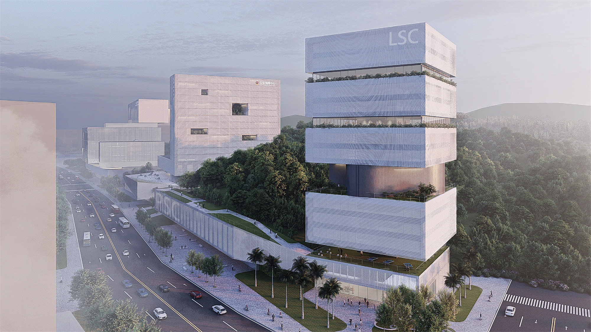
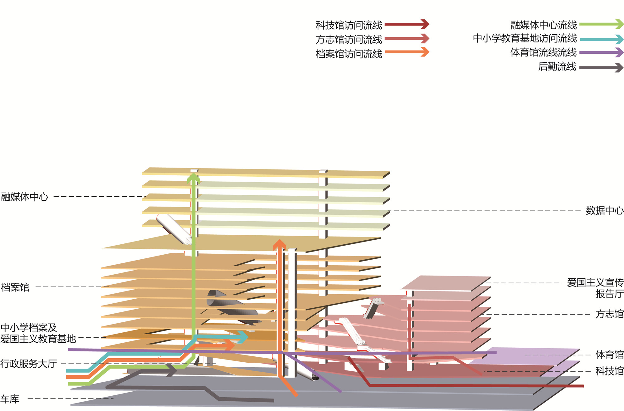
螺旋引擎
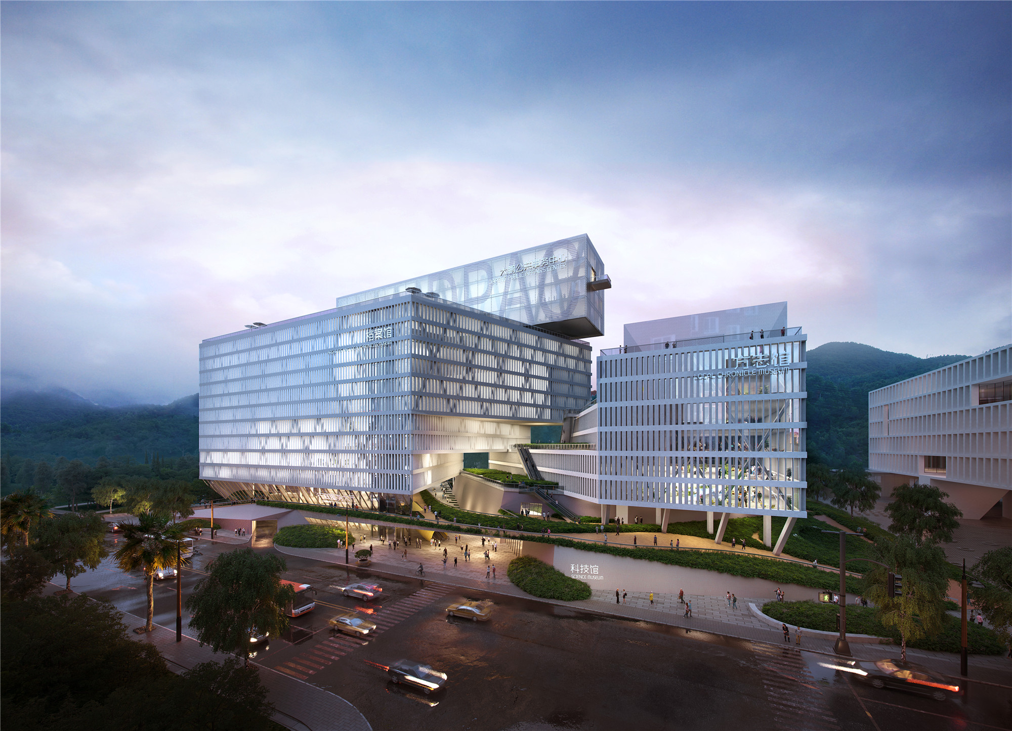
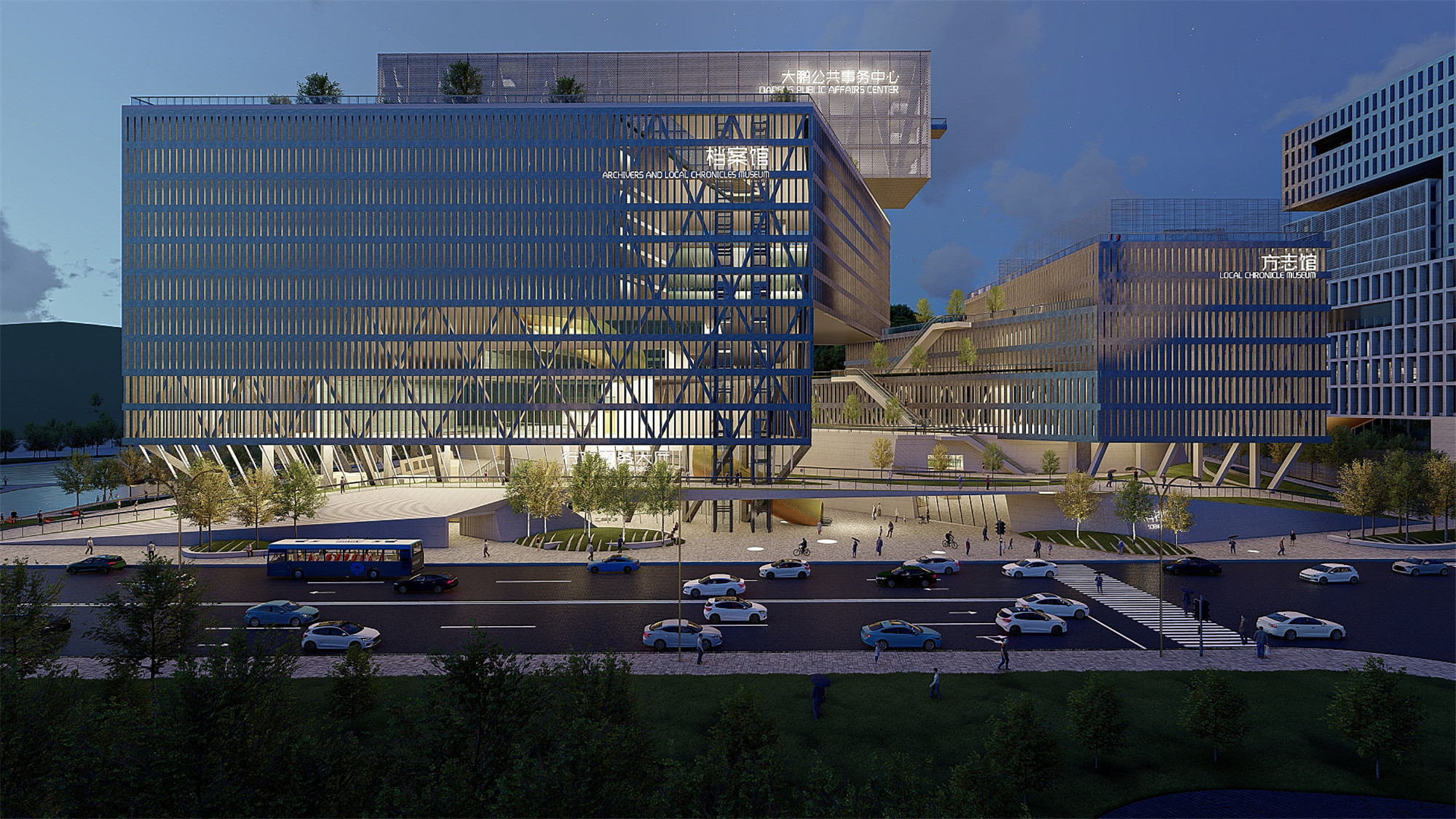
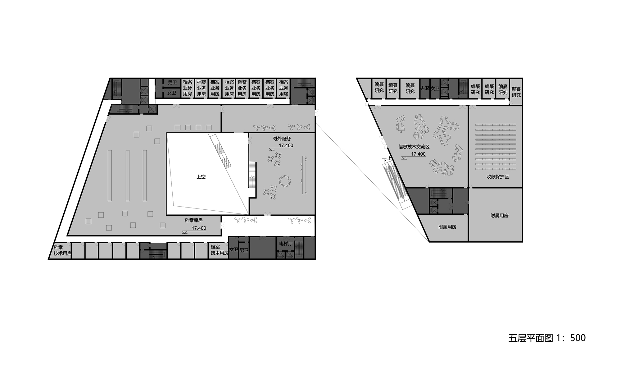
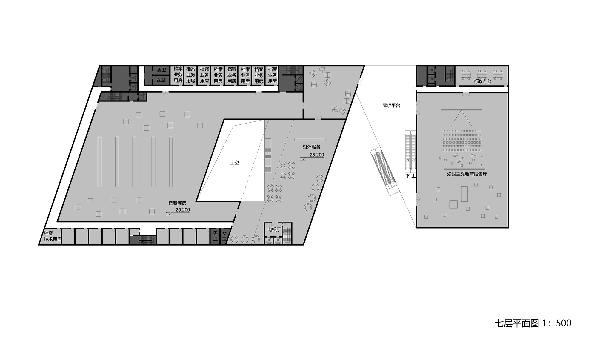
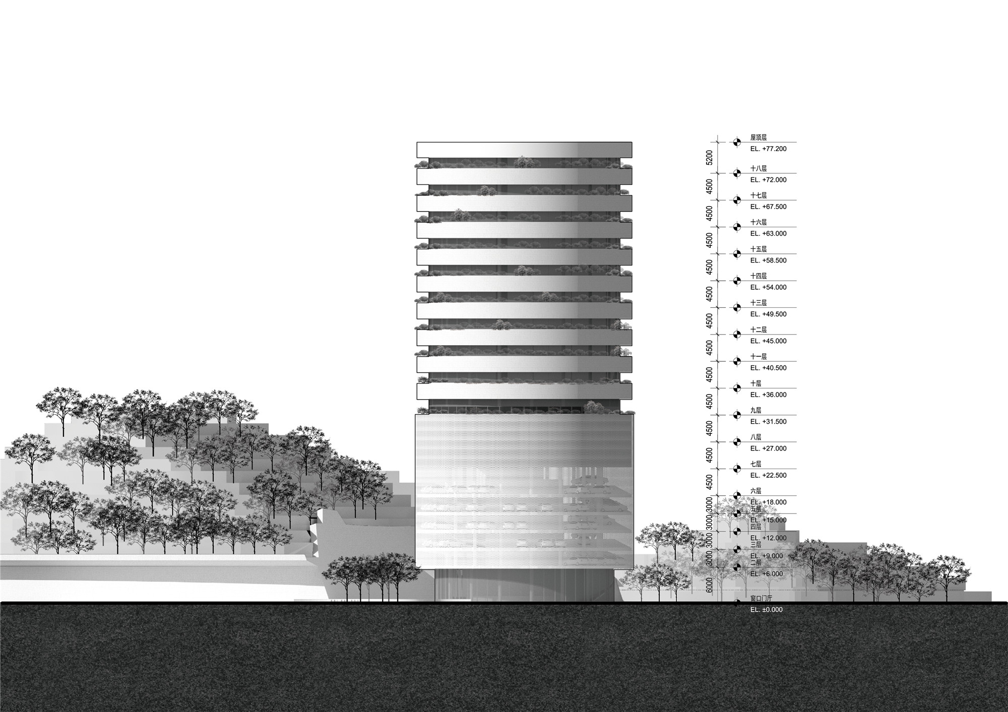
大鹏记忆中心
——
档案馆、方志馆与科技馆
存放过去(方志馆与档案馆)与展示未来(科技馆)的各公共功能,共同组成了一个精密的垂直建筑群落。
The public functions that store the past (Chronicles and Archives) and display the future (science and technology museum) together form a designed vertical building community.
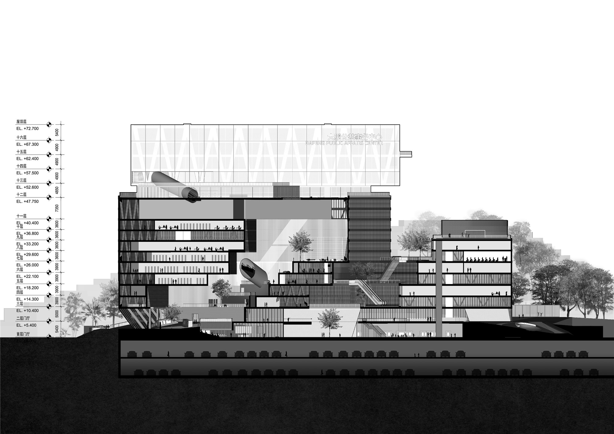
可全面向市民开放的科技馆是这个群落的城市界面,位于金岭路上。其在东西方向上水平延展,形成一个与金岭路平行的通透立面,将馆内不断变化的展览内容若橱窗一般展示给城市,点亮街道。而在建筑组团的最上方是公共性较低的“融媒体中心”与“数据中心”,它们是整个建筑群落的数字大脑。
The community’s urban interface is the science and technology museum which is open to every citizen. It is located on Jinling road. On this road, the science and technology museum forms a transparent facade from east to west, which displays the changing content of the exhibition to the urban space and lights the street view. At the top of the building, groups are the "Media Center" and "Data Center", which are the digital brains of the entire building community and less exposed in public.
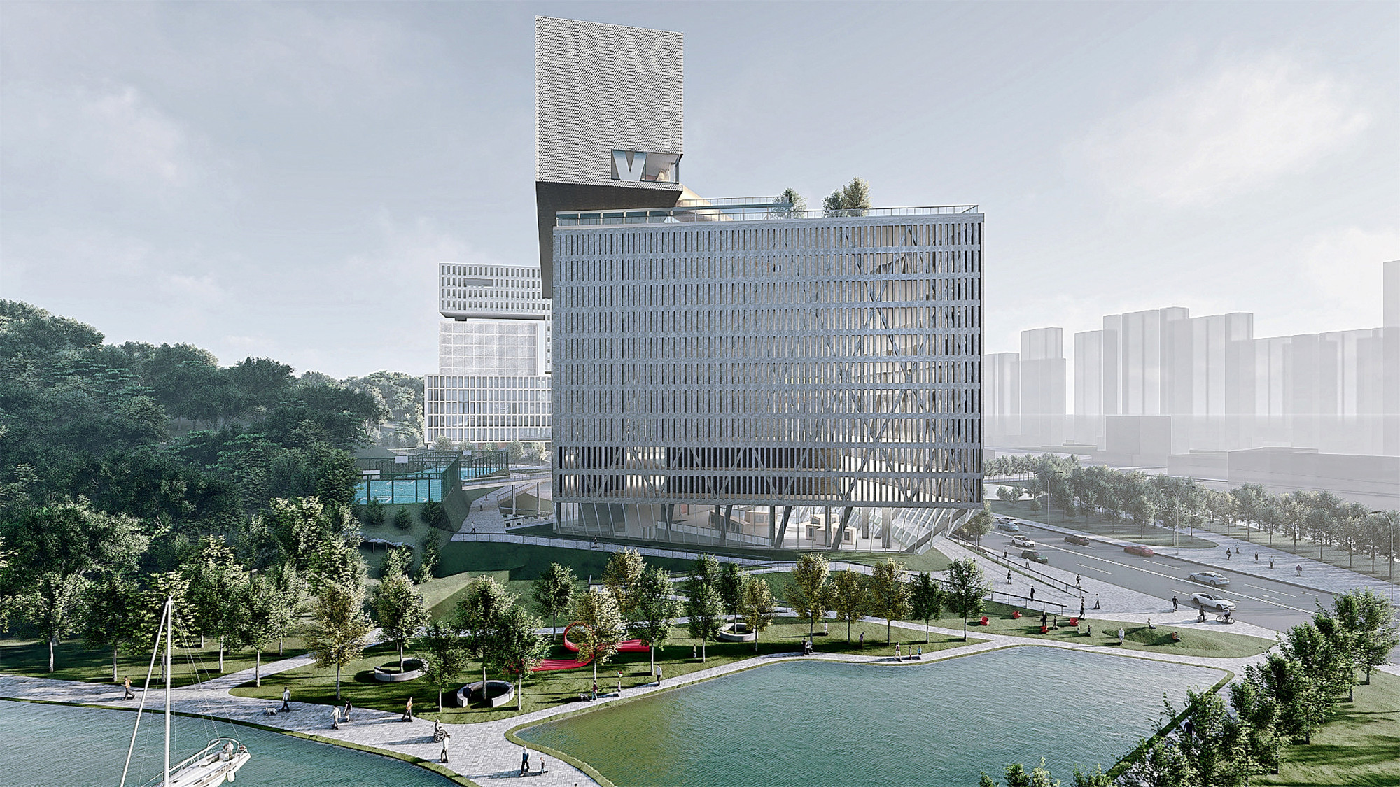
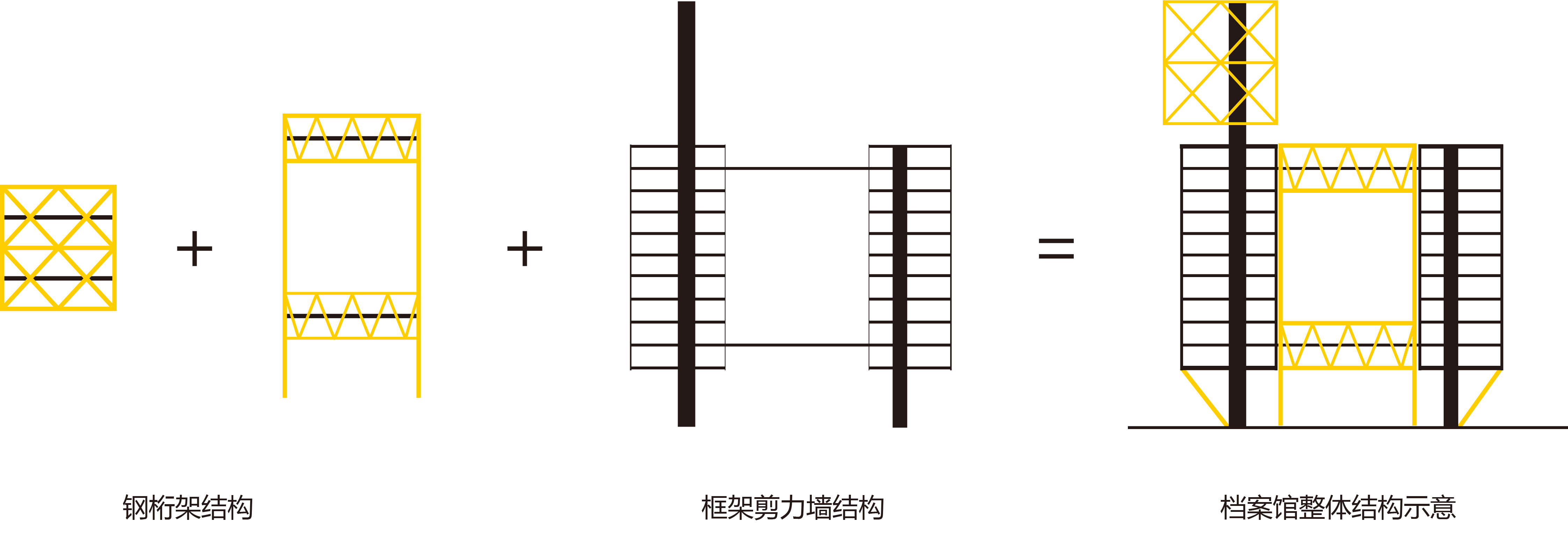
拥有大量储藏空间的档案馆与方志馆肩并肩地位于垂直建筑群落的中段,其相对封闭的形象(有利于资料的保存与节能),清晰无误地向城市表明它们是存储城市记忆的“容器”。
Archives and Chronicles have a large amount of storage space, which are distributed together in the middle part of the vertical building community. The relatively closed and solid appearance(beneficial to the preservation of data and energy saving)clearly indicates to the city that they are "containers" for storing the city's memory.

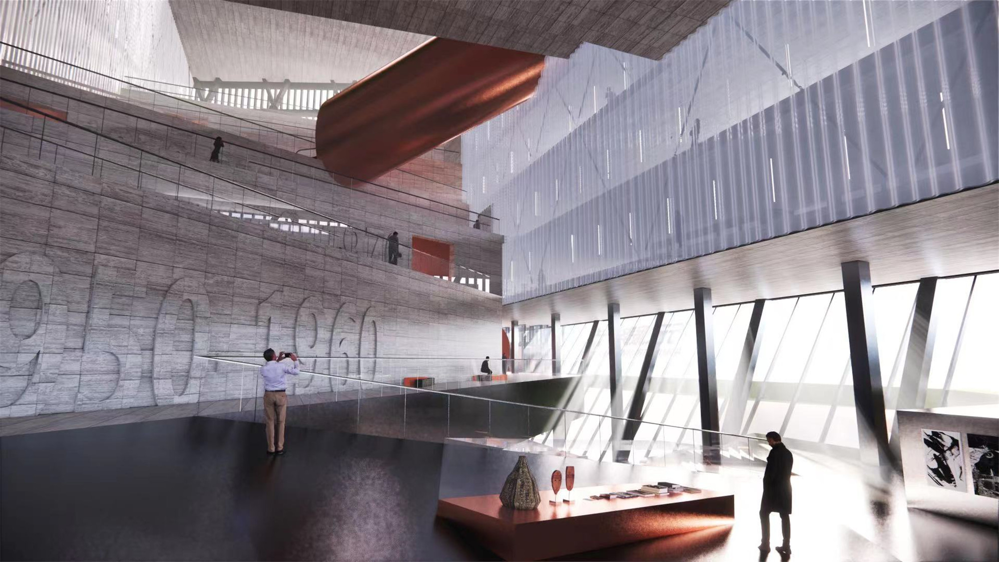
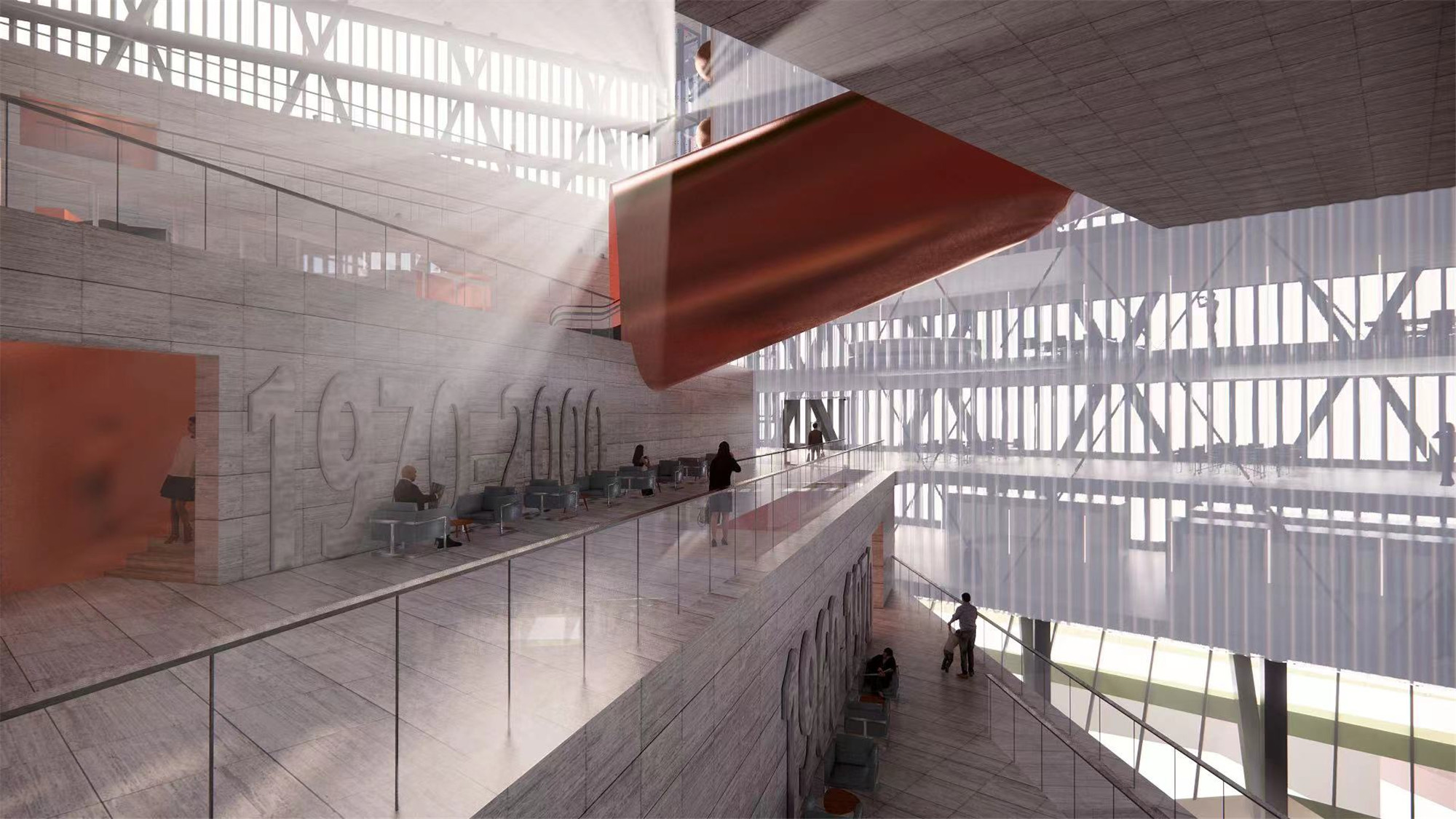
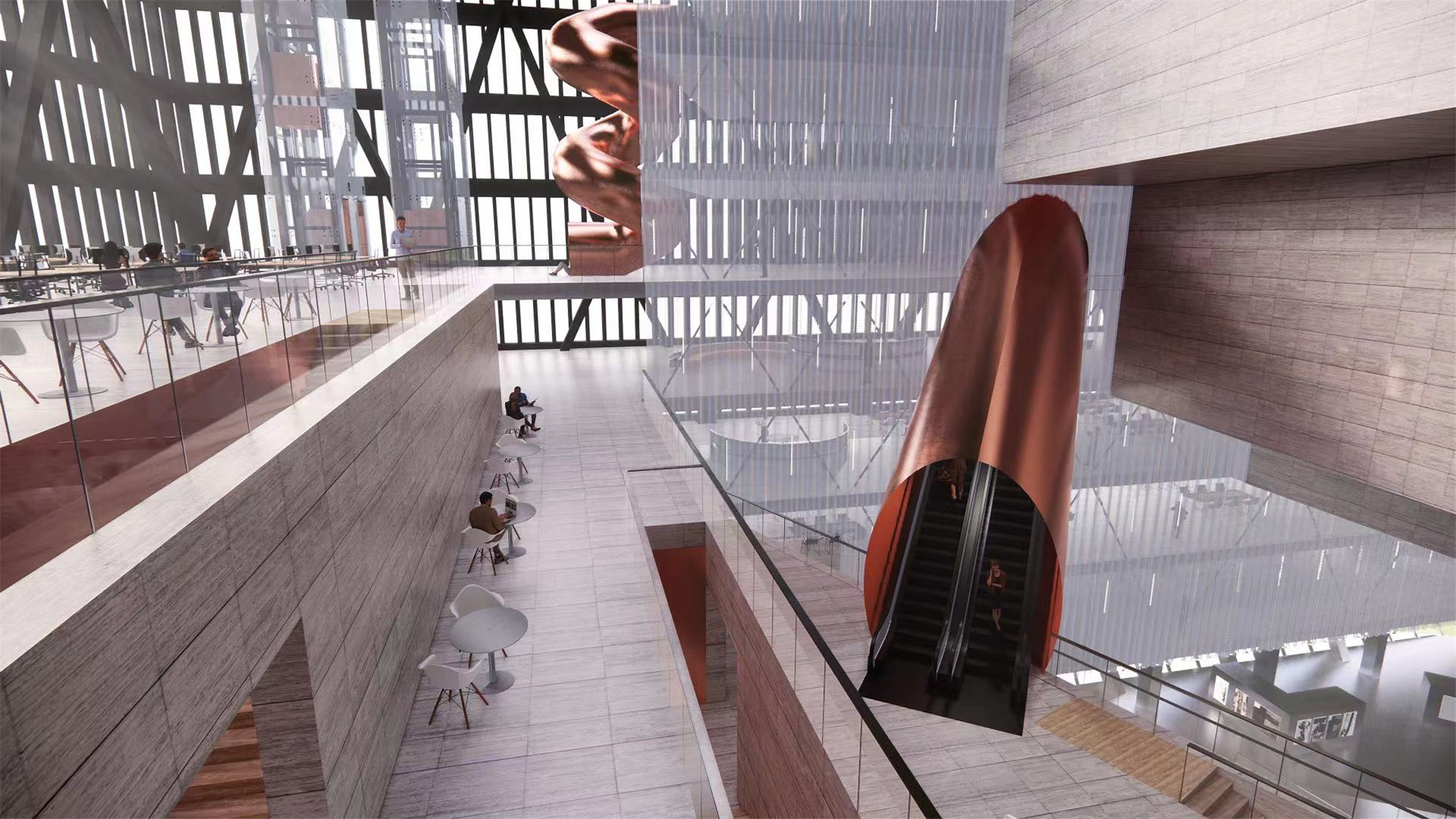
两馆之间是一个“双螺旋”的缝隙,既定义了两个不同管理主体的边界,又形成了从城市望向笔架山的视线通廊,还提供了一系列精彩的“看与被看”平台。其最高潮的部分是距地面46米高的两馆屋顶,这一可由地面直达的“景观天台”与“爱国主义教育基地”,允许市民登高眺望,饱览大鹏新区的山海景色。
There is a "double helix" gap between the two museums, which not only defines the boundary of the two different management department, but also leads the sight corridor from the city to Bijia Mountain. The sight corridor offers a series of spectacular "see and be seen" platforms. The most extraordinary platform is the 46-meter-high roof of the two museums, which can approach from the ground and used as "Landscape Roof" and "Patriotism Education Base". it is allowed overlooking and enjoying the scenery of the mountains and sea in Dapeng New district.


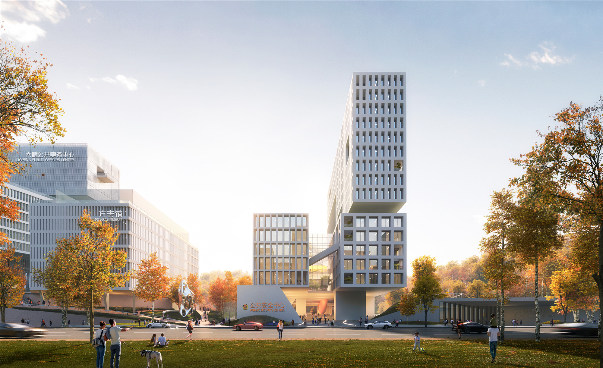
漂浮方舟
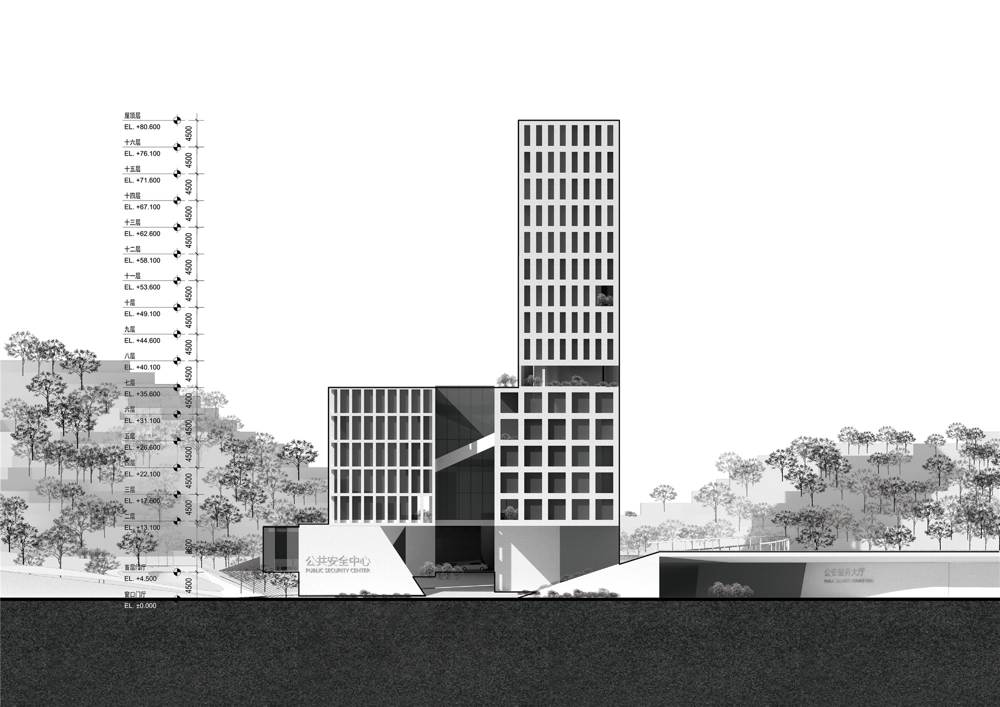
公共安全中心
——
公共事务大厅、公安指挥中心
设计师将公安指挥中心与交警营房的办公部分进行有条件地整合,并将两者的后勤生活功能合并,可以得到一个对于场地利用以及整个城市片区更加有效的方案:
Designers are going to public security command center and the office part of the traffic police barracks in conditional integration, and incorporating both logistics function of life, get a for field use, and the whole city area more effectively plan:
新的公安指挥中心与交警营房的办公功能形成了“公共安全组团”;它居于整个场地的中央。设计将公安与交警各自的窗口部门(包括车管所等一系列对市民开放的功能)剥离并整合,形成“公共事务大厅”,居于悬浮广场下。这为庄重的公共安全中心塑造了一个极为公共、亲切而透明的城市形象。它让科技馆所激活的城市街道得以继续向东延伸,打通了金岭路的公共走廊。
The new public security command center and the office of traffic police barracks function to form the "public safety group"; It sits in the middle of the whole site. We separated and integrated the window departments of the public security and traffic police (including a series of functions open to the public, such as the DMV) to form a "public affairs hall" under the floating square. This creates a very public, intimate and transparent city image for the dignified public safety center. It allows the city streets activated by the museum to continue to the east, opening up a public corridor on Jinling Road.


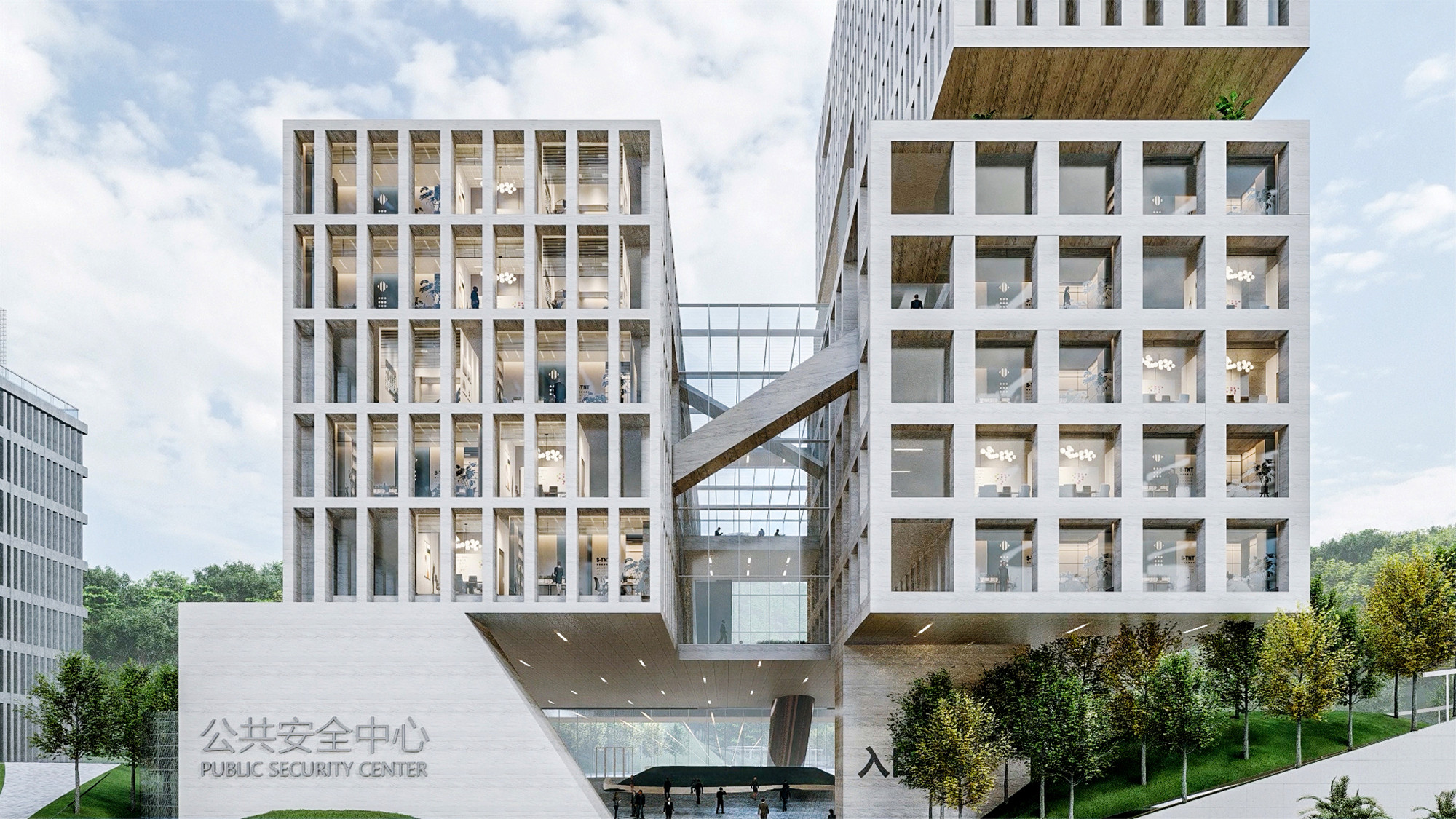
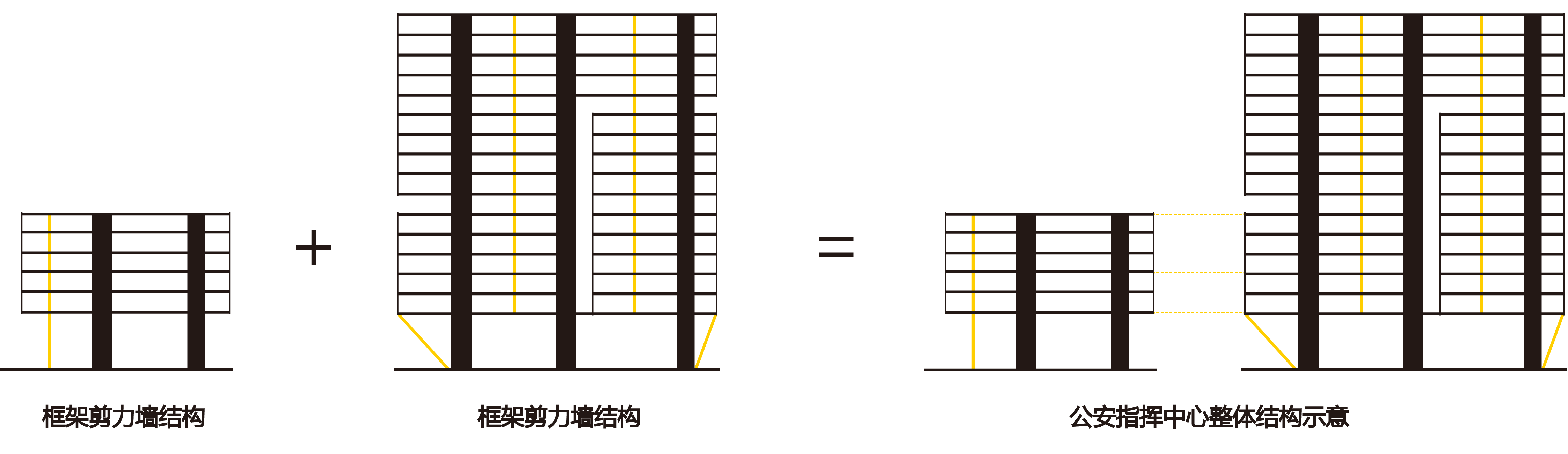
公安指挥中心与交警营房有着明显的规模区别,设计希望两者既能有各自独立的形象表述,又能和谐地作为一个整体。所有的办公空间均采用15米宽的板式高层,以在白天获得完全的自然采光与通风,使建筑能耗得到控制。
There are obvious scale differences between the Public Security Command Center and the traffic police barracks. We hope that the two can not only have their independent expression but also be harmonious pairs. All office space is 15 meters wide plate high-rise, to obtain enough natural lighting and ventilation during the daytime, so that the building energy consumption can be controlled.
巨大的公安指挥中心楼呈南北走势,一方面获得东侧开阔的山景,一方面以优雅俊秀的形象面对城市,最大程度尊重身后的群山与自然。规模显著较小的交警营房与指挥中心呈正交布置,拥有清晰的城市界面。需要无柱大跨空间的“公安指挥大厅”水平向将两座办公建筑连接起来,同时为下方的悬浮广场提供深圳气候下亟需的阴凉。
The huge Public Security Command Center building presents a north-south trend, on the one hand, obtains the east side open mountain view, on the other hand, faces the city with the elegant architectural language, shows the biggest respect to the mountains and the nature behind. The significantly smaller traffic police barracks and command center are orthogonal layouts and have a clear urban interface. The "Public Security Command Hall ", which requires a large span of space without columns, horizontally connects the two office buildings and provides enough shade below the suspension square in Shenzhen.


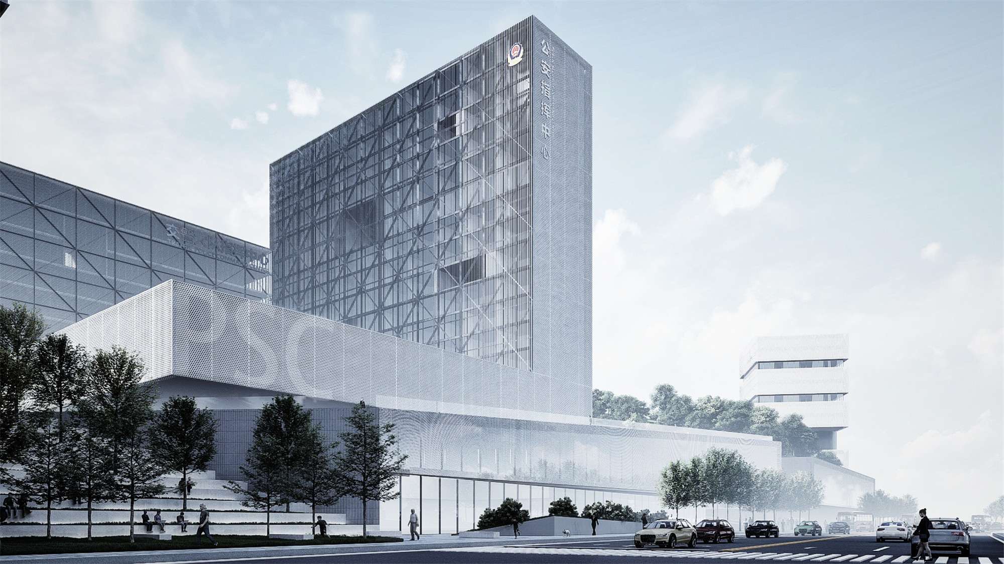
垂直灯塔
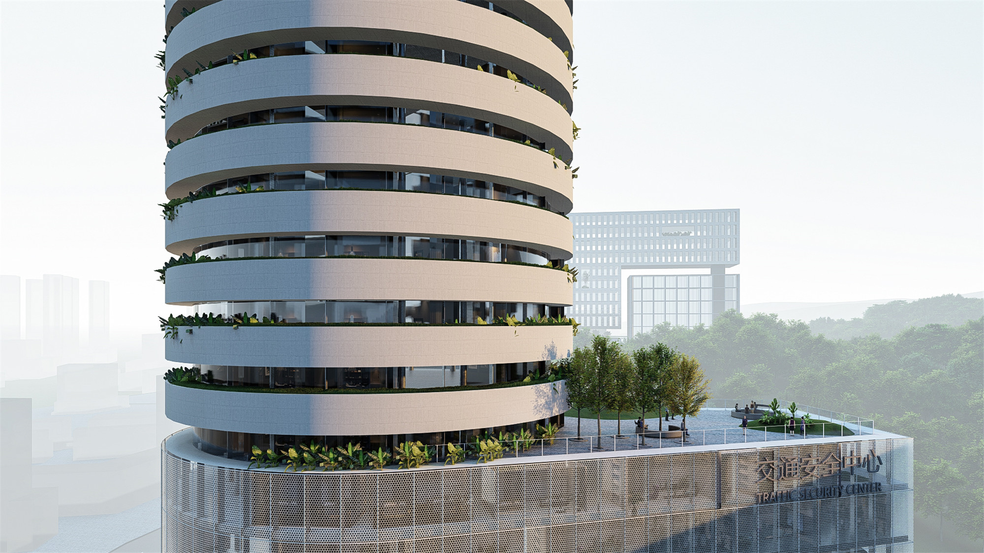
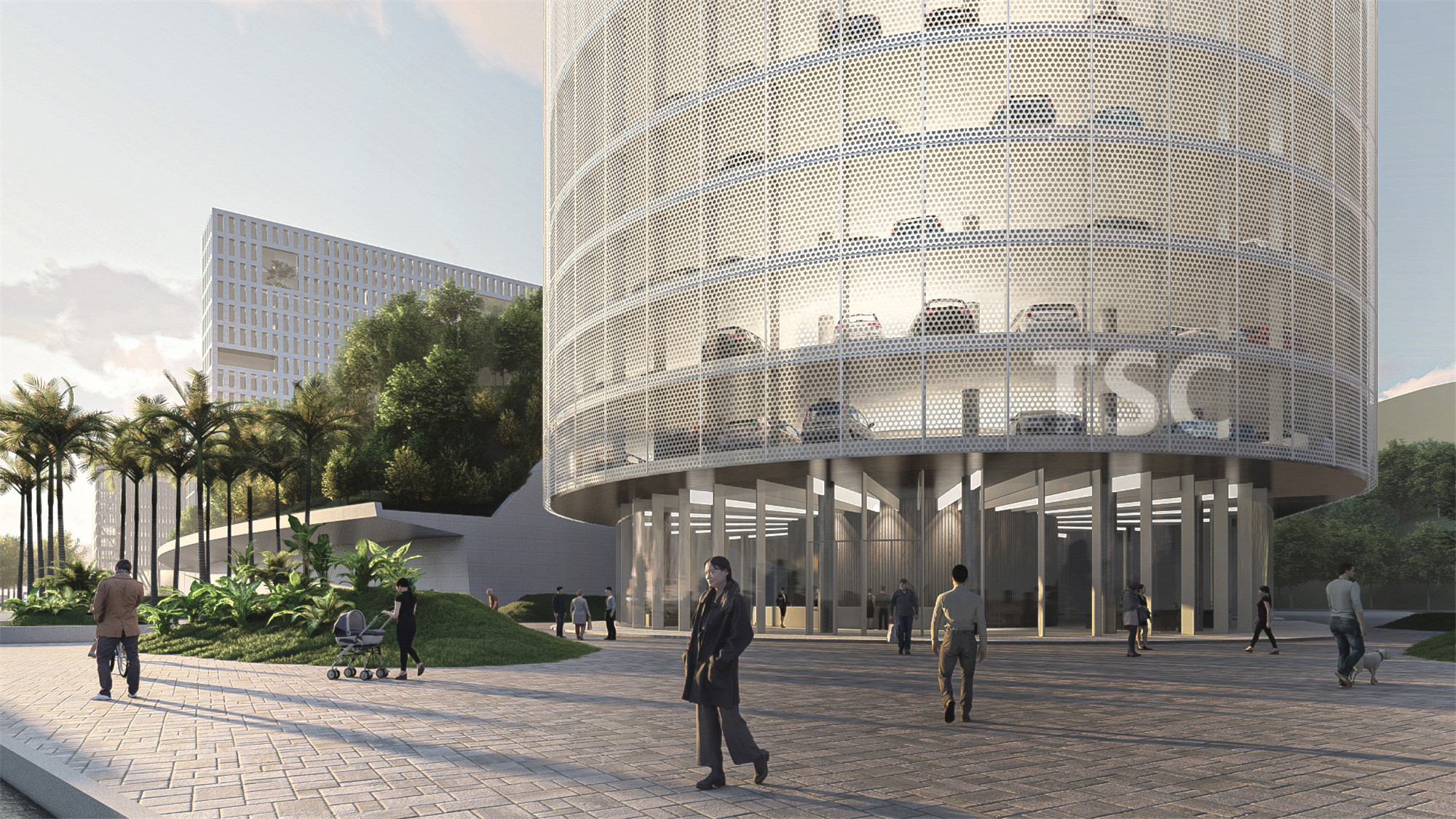
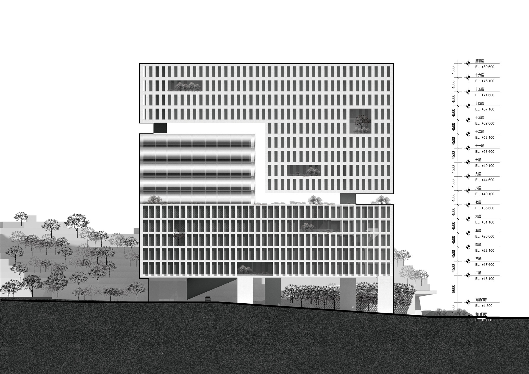
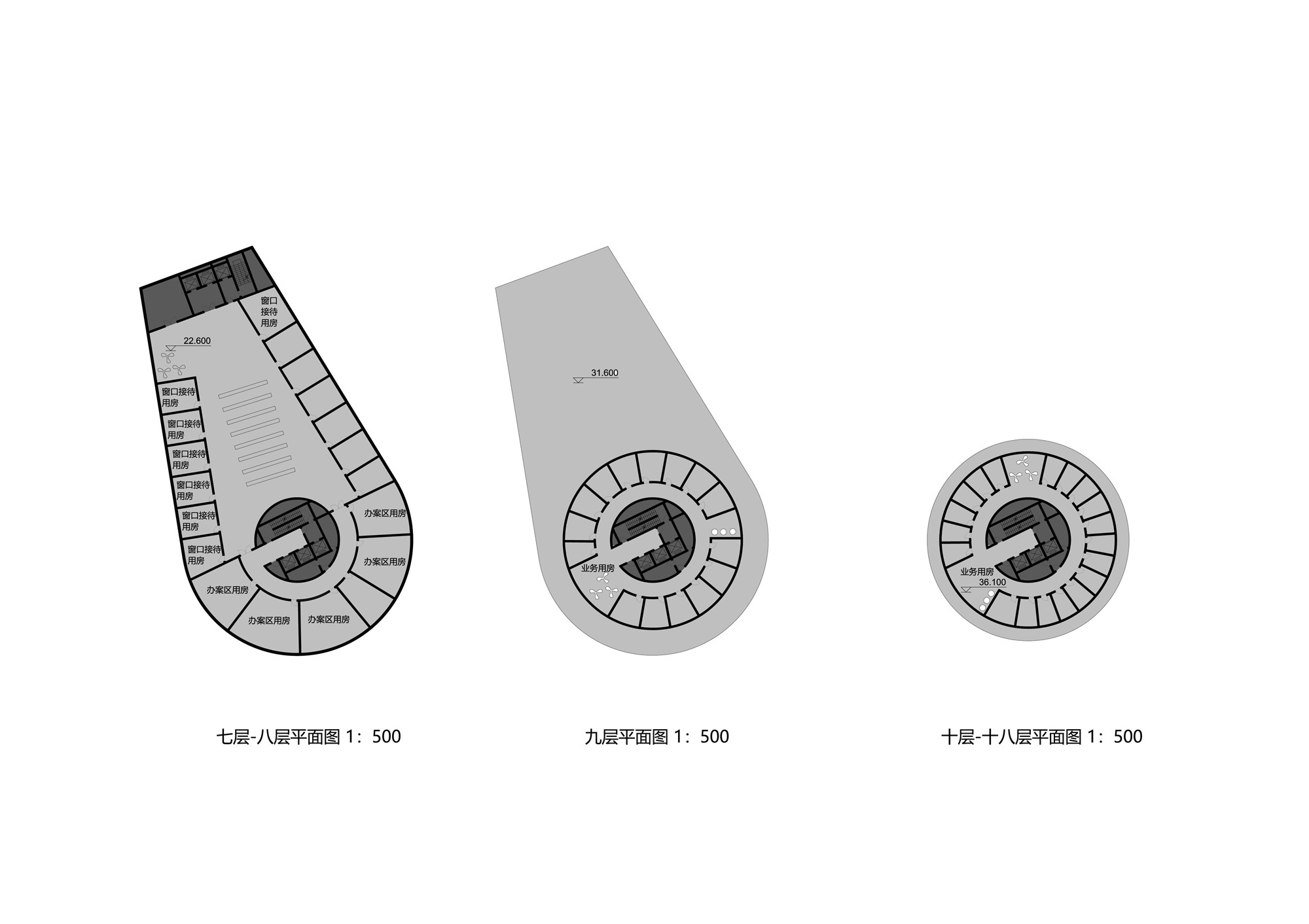
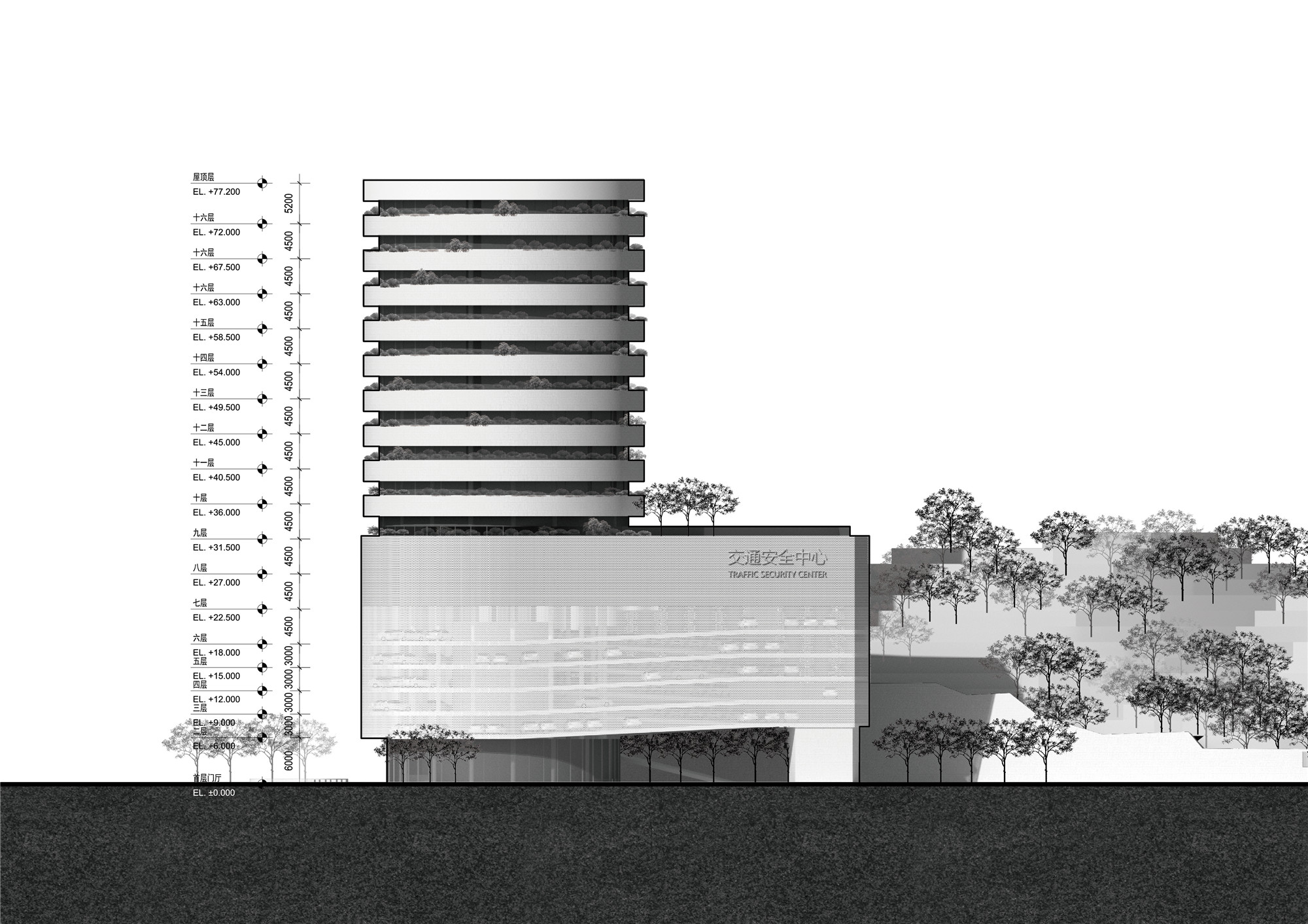
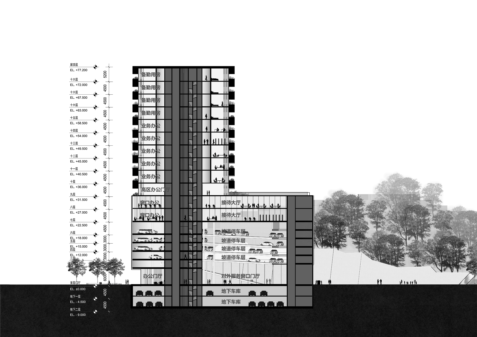
交通安全中心
——
交警办公及立体停车

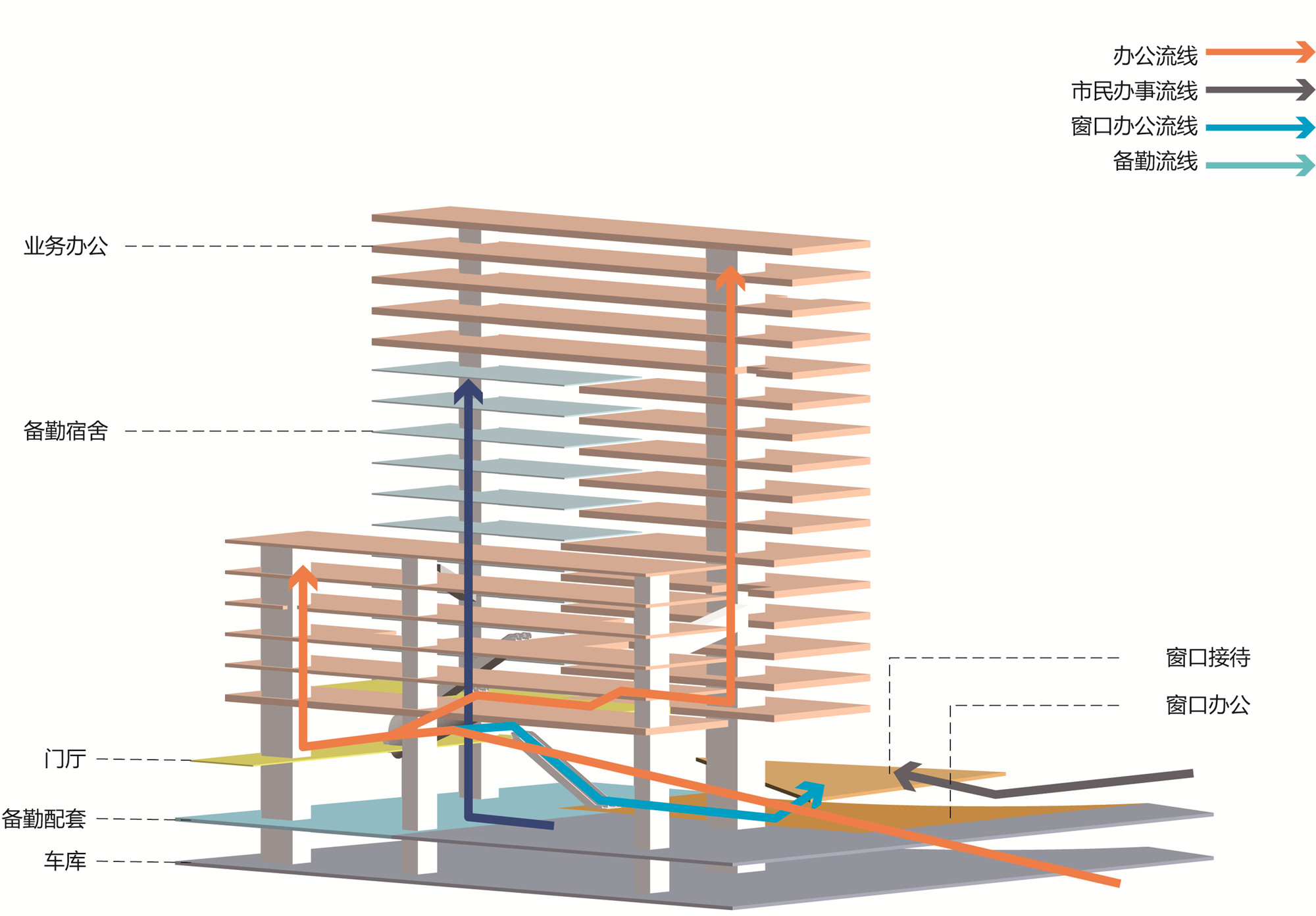
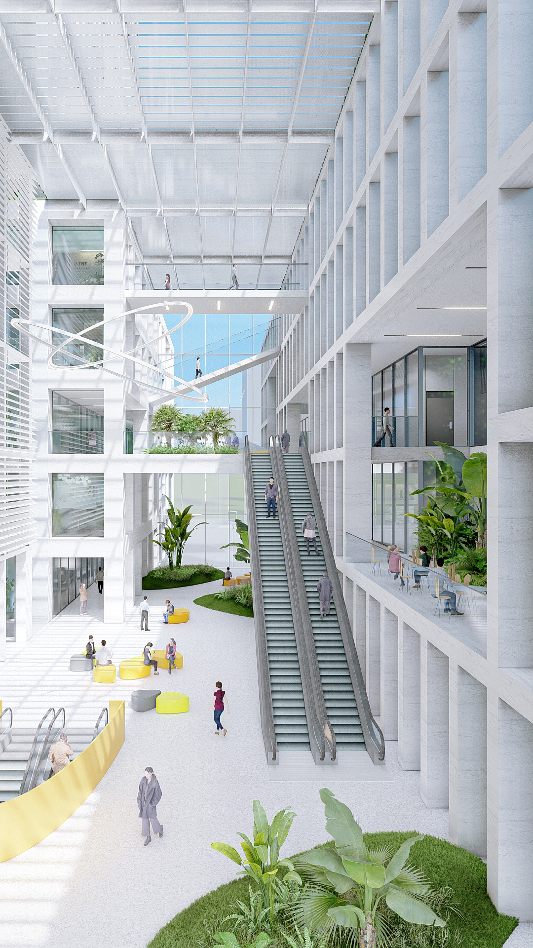
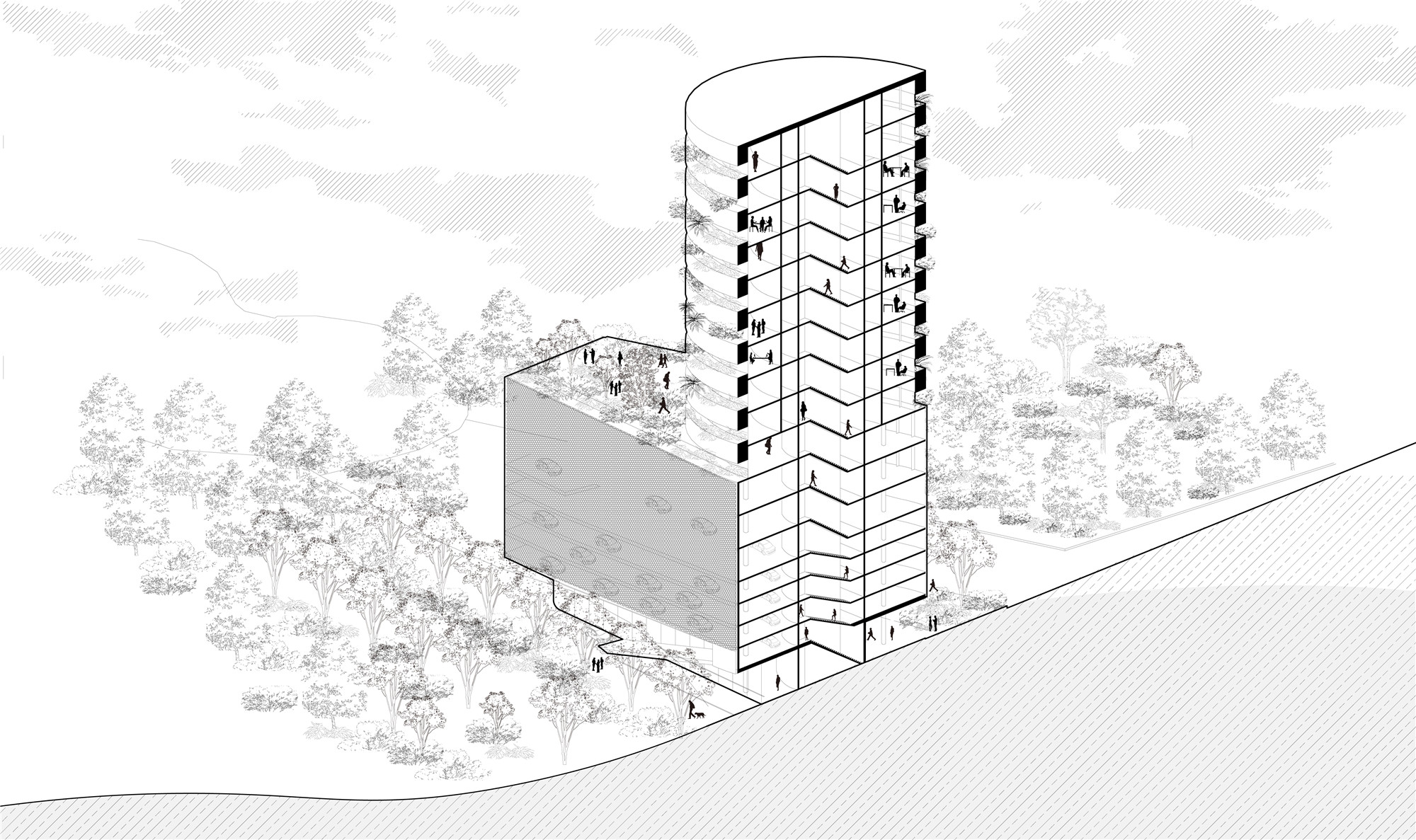
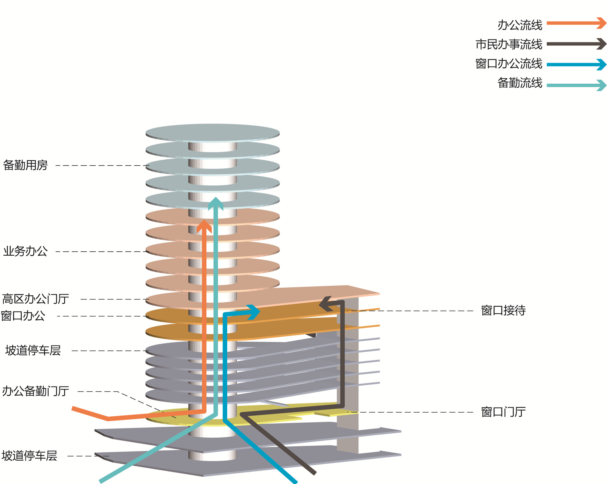
由于场地限制与功能要求,建筑被设想为一个极具效率的“垂直交通塔”。公共服务大厅、立体坡道停车楼、窗口单位办公、交警大队办公及备勤等被垂直叠加,形成了一个由汽车、人、植物、与行为构成的风情画。在体现交警机构的特点之上,构建了一个全新的集约式机构模型。
Due to site constraints and functional requirements, the building is conceived as a highly efficient "vertical traffic tower". The public service hall, the three-dimensional ramp parking building, the office of the window unit, the office, and duty preparation of the traffic police brigade are vertically superimposed, forming a landscape painting composed of cars, people, plants, and behaviors. Based on the characteristics of traffic police agencies ,a new intensive mechanism model is constructed.


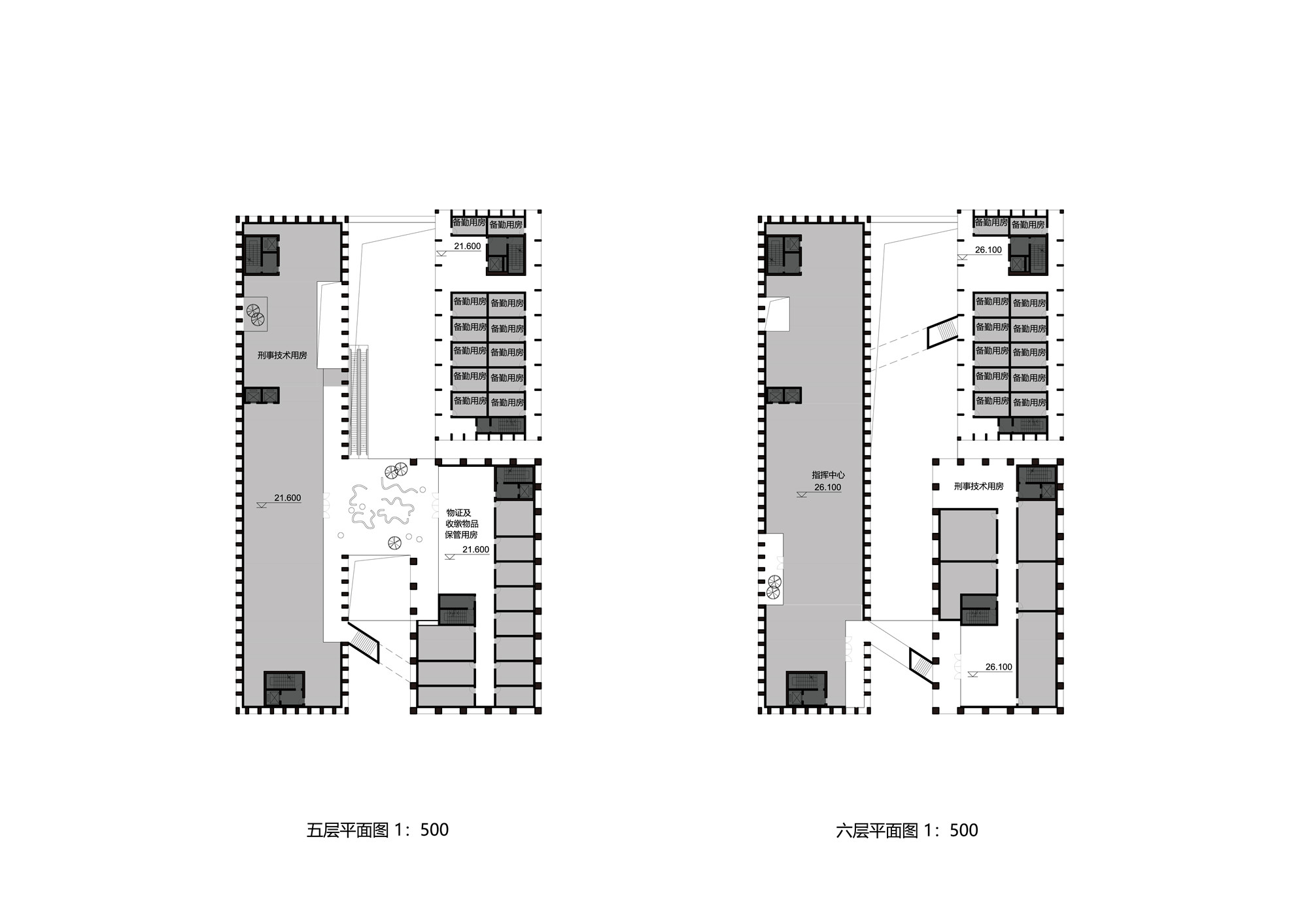
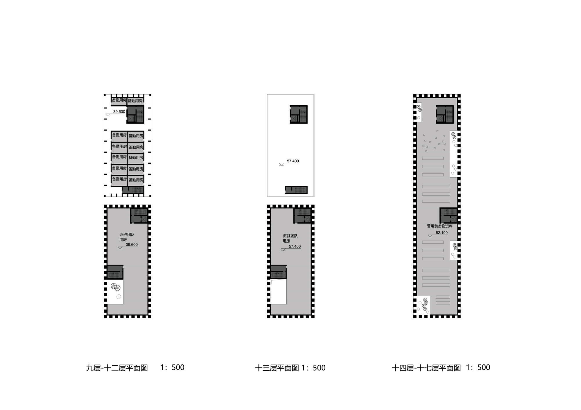
设计图纸 ▽


完整项目信息
设计时间:2021年6月
功能:展览、研究、行政、宿舍、餐饮、停车、藏品保管与保护等
用地面积:45268平方米
项目地点:广东深圳
设计单位:普罗建筑+也似建筑+深圳建科院
主持建筑师:常可、李汶翰、罗韧、赵耀、杨文雄
设计团队:王盈力、葛洋、王楠、姜红辉、赵建伟、陈纪元、邹汶蓉、张文娟、朱柏圳、辛星
版权声明:本文由普罗建筑授权发布。欢迎转发,禁止以有方编辑版本转载。
投稿邮箱:media@archiposition.com


上一篇:河北华奥医院 / 维思平建筑设计
下一篇:石上纯也为2021年泰国双年展设计“彩虹地毯”,薄拱跨越城市运河