
很抱歉,没有找到 “” 相关结果
请修改或者尝试其他搜索词
设计单位 MYP迈柏
项目地点 内蒙古呼伦贝尔
建成时间 2018年
用地面积 258万平方米
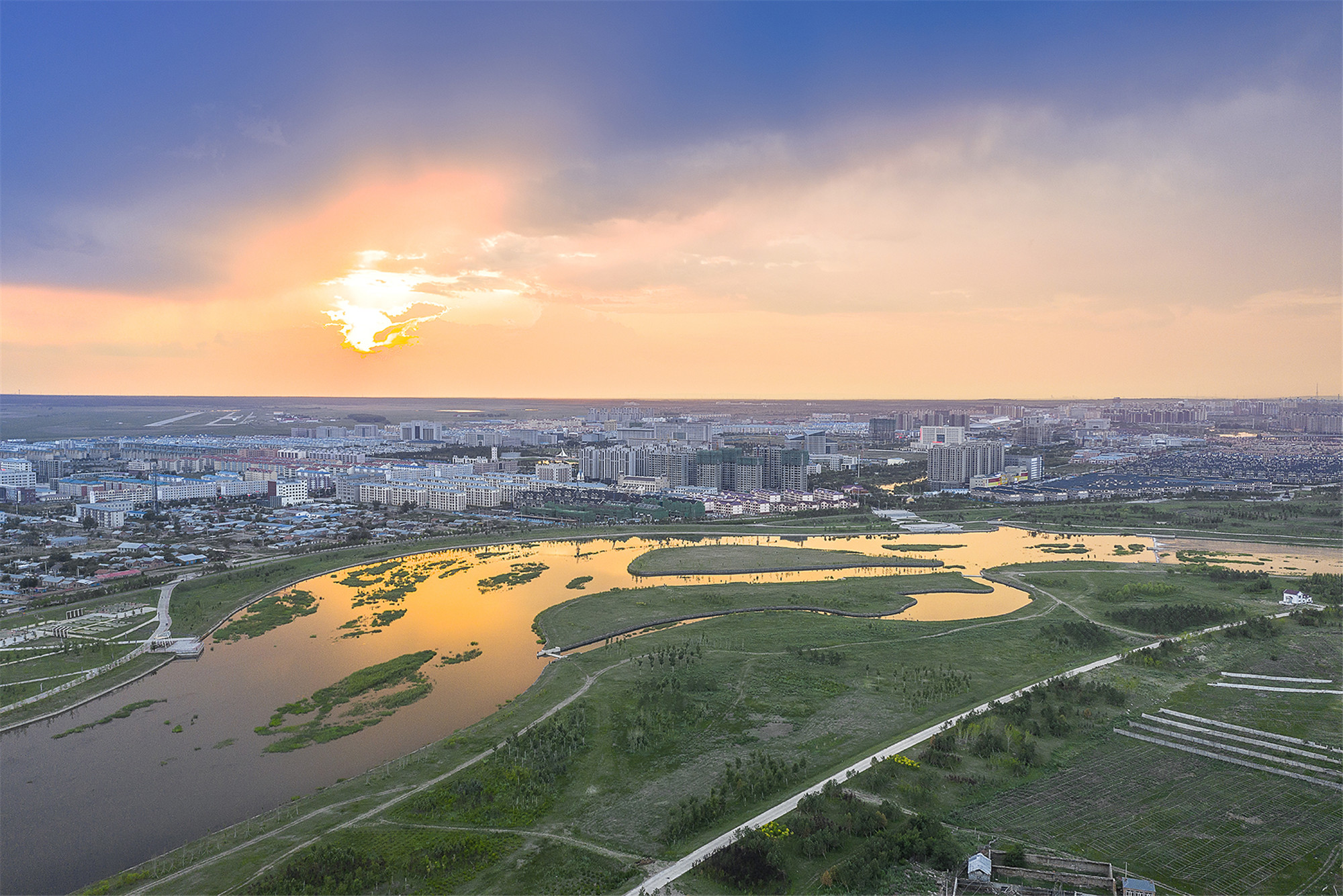
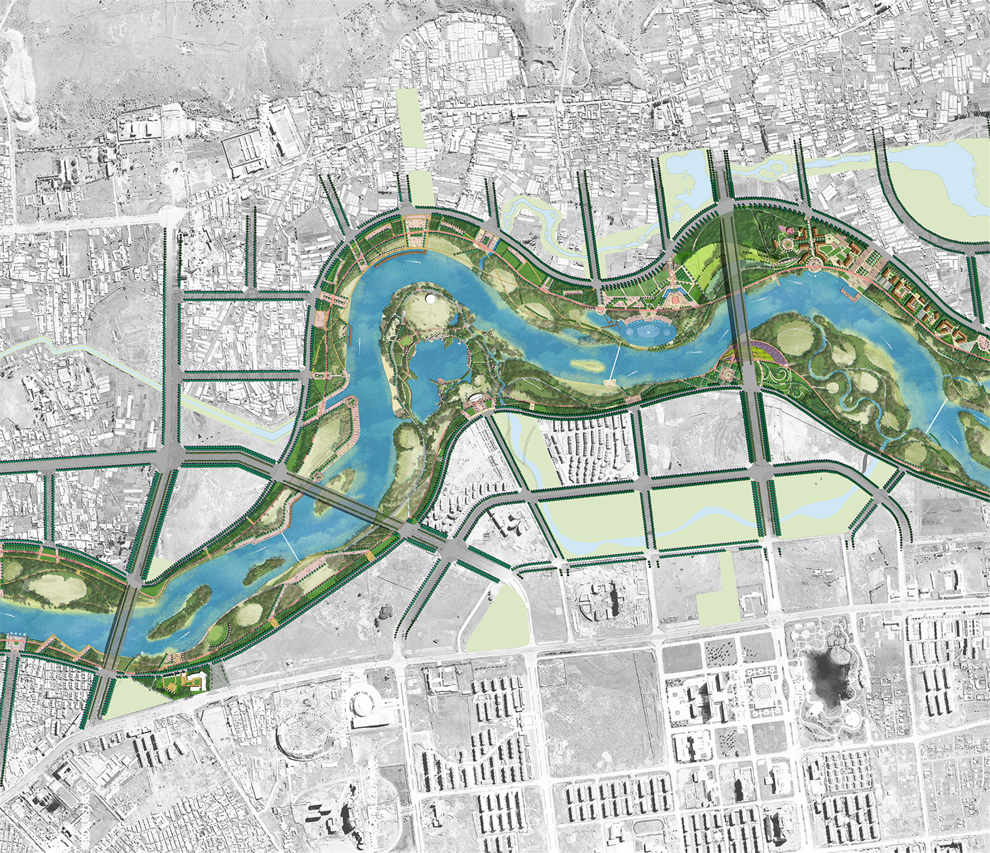
伊敏河,纵贯内蒙古呼伦贝尔草原地带,哺育着世世代代的呼伦贝尔人。随着城市向南发展,“草原游荡型河流”所持有的脆弱自然要素却正在消失。自2013年建设以来,伊敏河新城滨水公园致力于修复受到破坏的河道驳岸,恢复河滩乡土自然植被,并兼顾在不同的洪泛区域中创造市民的弹性使用空间。
背景与挑战
呼伦贝尔拥有十万平方公里的辽阔草原,是中国北方游猎、游牧民族的发祥地。草原河流依托于平坦的草原地貌,主河道并不固定,会根据雨水量的变化而进行季节性游荡。它为草原表层提供水源,也为土壤提供养分,促进了草原景观的演替和生物多样性的改善,所以被称之为“草原游荡型河流”。近年来由于拦坝蓄水、河床挖沙、防洪渠化等现象,“草原游荡型河流”原本就脆弱的生境受到了破坏,整个大草原的沙化现象日趋严重。
Hulunbuir Prairie, with a vast grassland of 100,000 square kilometers, is the birthplace of the ancient nomadic people in northern China. The grassland riverway wandering across the flat landform due to seasonal rainfall, winter waters and ice build-up. The river provides water and sediments for promoting the succession of grassland biodiversity. Therefore, it is called "Grassland Wandering River". In recent years, the fragile ecology of " Grassland Wandering River" has been damaged, accelerating the desertification of the whole Hulunbuir Prairie.
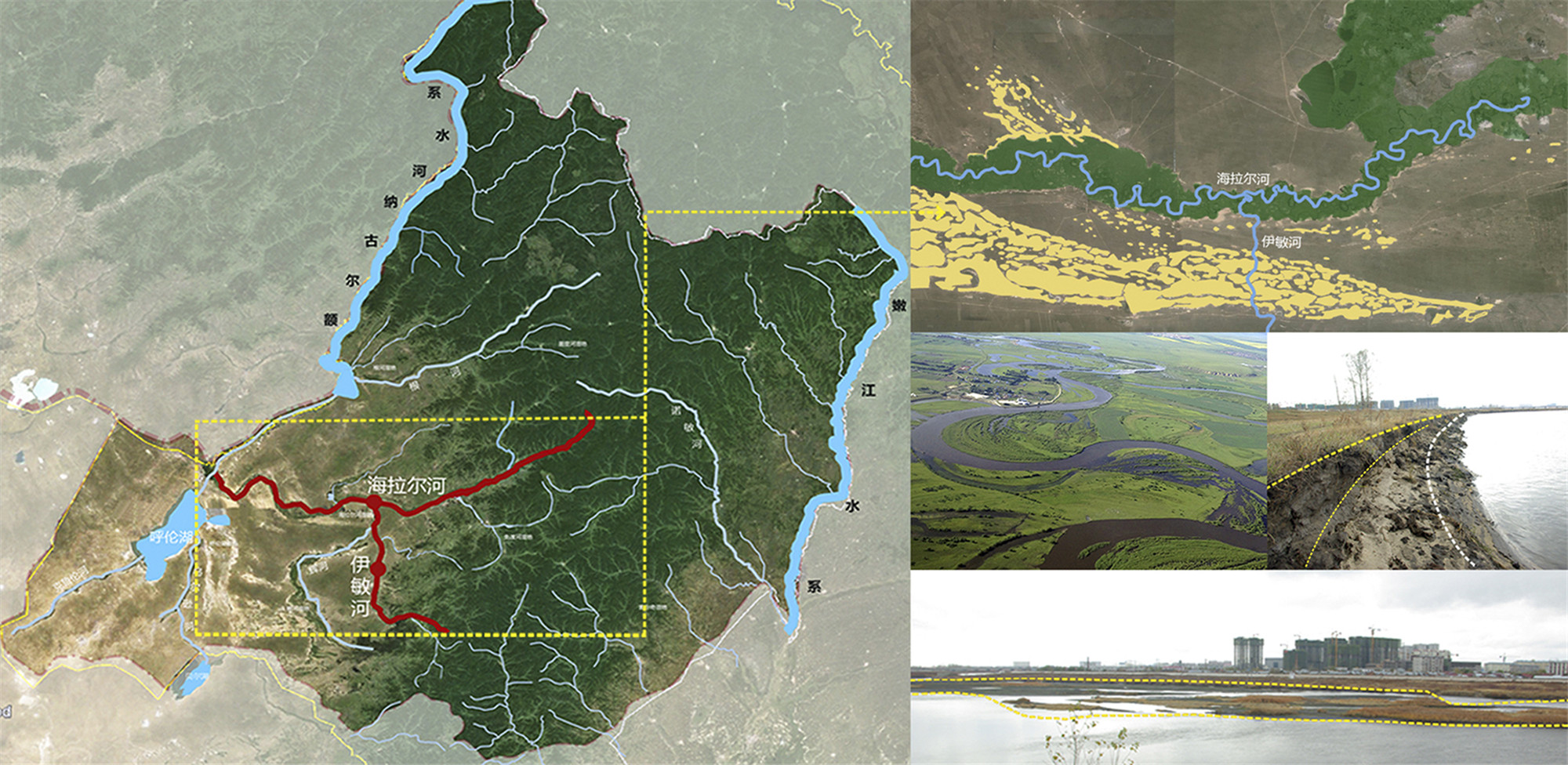
伊敏河,作为典型的“草原游荡型河流”,具有不定型的河道线型、尺度巨大的滩地,以及脆弱的土壤和植被等特点。在过去的几十年中,伊敏河逐渐由一条城市边缘性河流演变为城市中心河流。在城市南拓的建设中,为应对河流的行洪安全需求,伊敏河主河道被截弯取直,并进行了渠化处理。这大大地破坏了河道原有的生态功能,也为两侧的市民使用带来了困难。
Yimin River, as a "Grassland Wandering River", has the typical characteristics of a changeable waterway, with extensive floodplains, fragile soil and restricted vegetation. Yimin river has gradually transformed from a meandering river to an urban river in the past few decades. In order to meet the flood discharge safety regulation, the riverway of Yimin river has been straightened and channelized during the new town expansion. This has significantly influenced the original river ecology, and also brought difficulties to the uses of the residents along the river.

伊敏河公园通过对自然河道的恢复、滩地空间的重塑,以及沿河休闲与旅游功能的建立,为伊敏河构建了一个融合自然生态、城市休闲、文化旅游等元素的综合价值体系,致力于打造一个韧性的城市生态河道。从而实现“城市草原之河”、“讲述故事之河”、“活力不断之河”等目标,建设后的伊敏河成为了独特的城市大型草原滨河公园,使之成为内蒙古草原城市河道滨水建设的标志。
Through restoration of the natural riverway, reconstruction of the floodplain, and the establishment of riverside leisure activities, the park is committed to restoring a resilient urban river, realizing the vision of New Grassland River with nature, vitality, and storytelling. After the park has been opened, this project has become an exemplary model for river restoration in Inner Mongolia grassland region.

自然河道的软化修复
对伊敏河河道的修复,首先是对河道自然水文与植被的尊重,最大化保留其“草原游荡型河流”的特质要素。由于城市的防洪安全需求,伊敏河的自然河道受到了工程渠化的改造,河道的水流走向与自然植被受到了破坏。公园景观设计提出了对原有河道线型的恢复,并创造了一个泻湖以满足了季节性的行洪需求。这一举措最终受到了政府领导及水利工程师的认同,并得以在后期执行。
The natural riverway has been channelized in order to meet the flood safety regulation, which damaged the natural vegetation in the floodplain. The landscape team initiated a comprehensive strategy of recovering the original riverway and creating an extra lagoon, to meet the seasonal flood discharge demand.

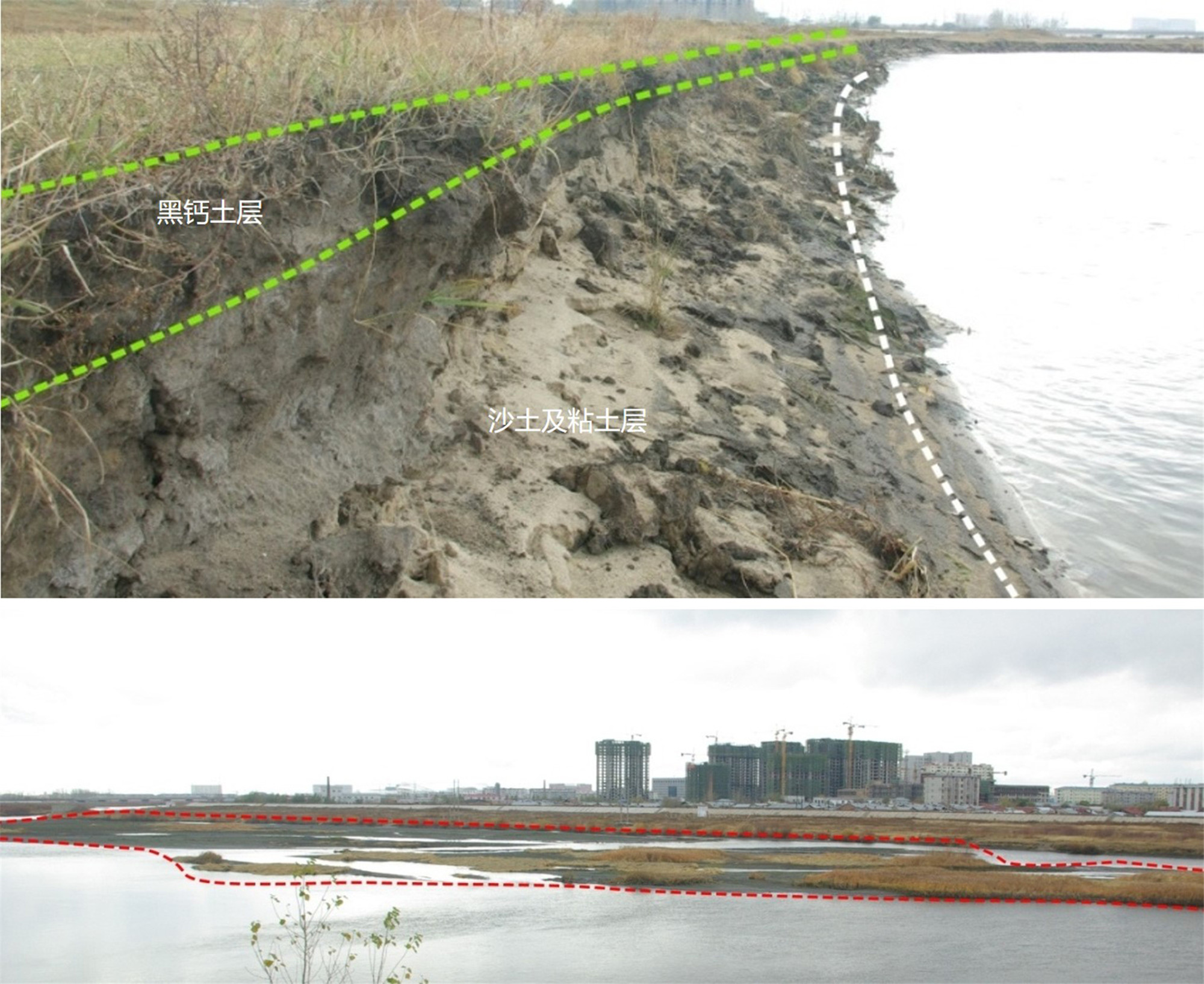
公园建设之始,河道驳岸已经被工程渠化,并留下了大面积裸露的滩地。景观设计师通过覆土及增加生态固土网的方式,对驳岸进行了最大程度的软化与绿化处理,实现了对河道水土的涵养及本地植被的恢复。在河道岸线重新柔化的基础上,设计师利用现有的岛屿与河道沉积对湿地进行恢复,从而保证了对河水的沉淀与净化作用,并为洪水期减缓洪水速度起到了良好效果。从主河道的平台上,人们看到的是一个河滩与河道一体化的一片青葱。
When recovering the river, the channelized riverway and bare floodplain have been the main challenges we confronted. The design team devoted to soften and afforest the revetment, which successfully achieved the conservation of river water and natural vegetation. With the “soft” river embankment, we restored the wetland in the river by using the existing sediments and islands, ensuring water cleaning, and also playing a positive role in slowing down the flood speed.
滩地区域的弹性使用
滩地,指的是在季节性雨季来临时洪水会溢出的区域。虽然它在大部分时间是广阔的场地,但作为有着500至800米进深滩地的公园,如何在这巨大的区域实现生态的修复,并平衡雨洪安全,实现合理的市民休闲使用是设计团队首要考虑的问题。
Floodplain refers to the area where the flood overflows when seasonal raining storms come. In the park, the floodplain covers an area extending 500-800 meters. Although the flood rarely occurs in the past years, the floodplain has been remained bare open. Therefore, how to achieve ecological restoration, as well as providing reasonable leisure use for the riverside community people, has been particularly vital for the park.


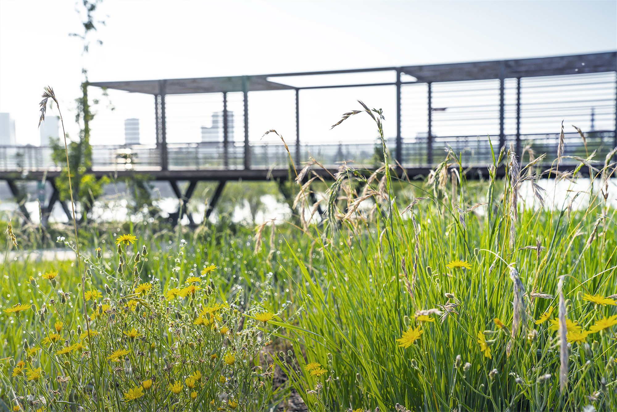
建设的第一步就是对滩地土壤进行平整,并利用河床清淤的土方对部分滩地进行换土,从而保证了整个滩地土壤的品质,实现了对草地的修复。局部滩地仍留存有杨树等植被,设计师借机对其进行了修复并搭配了新的植物,形成了河道富有特色的乔木群落。
The first step is to clean and fertile soil in the floodplain. In some area, we have to use the river dredging dirt to replace the existing soil, to ensure successful revegetation. There are still some poplars and willows on the site, which have been conserved and matched with a palette of local plants to establish characteristic planting communities along the river.

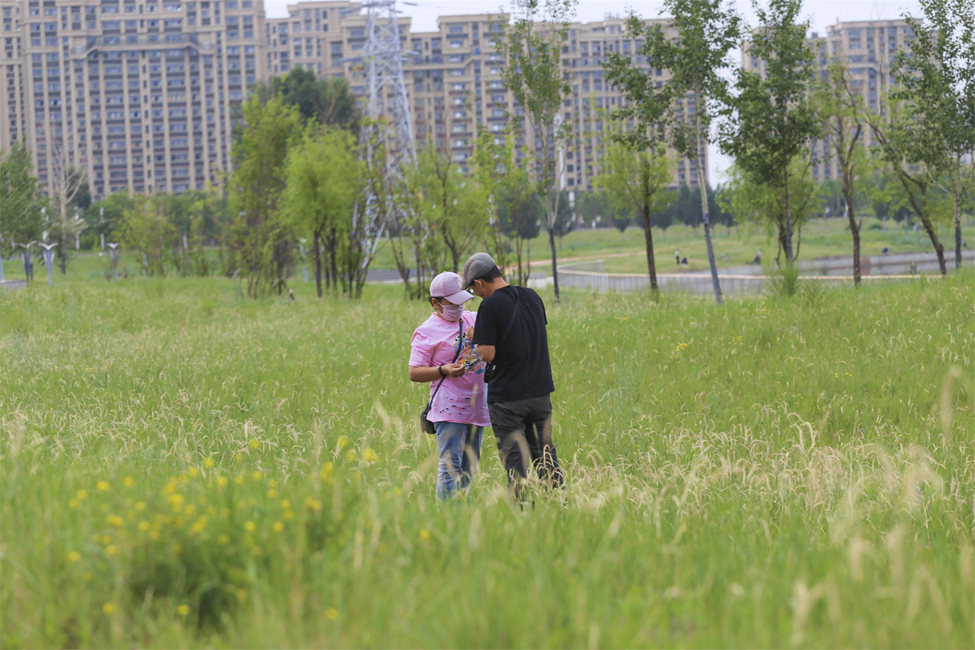
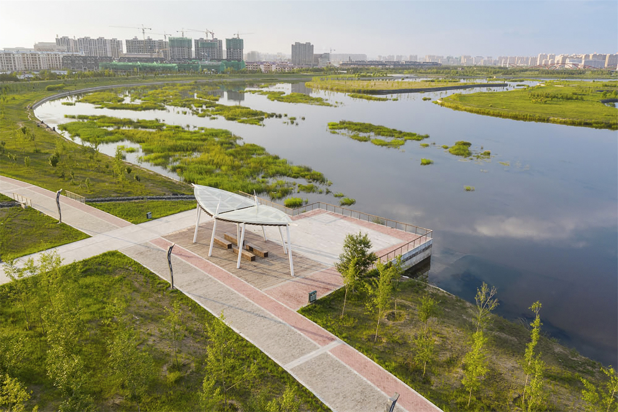
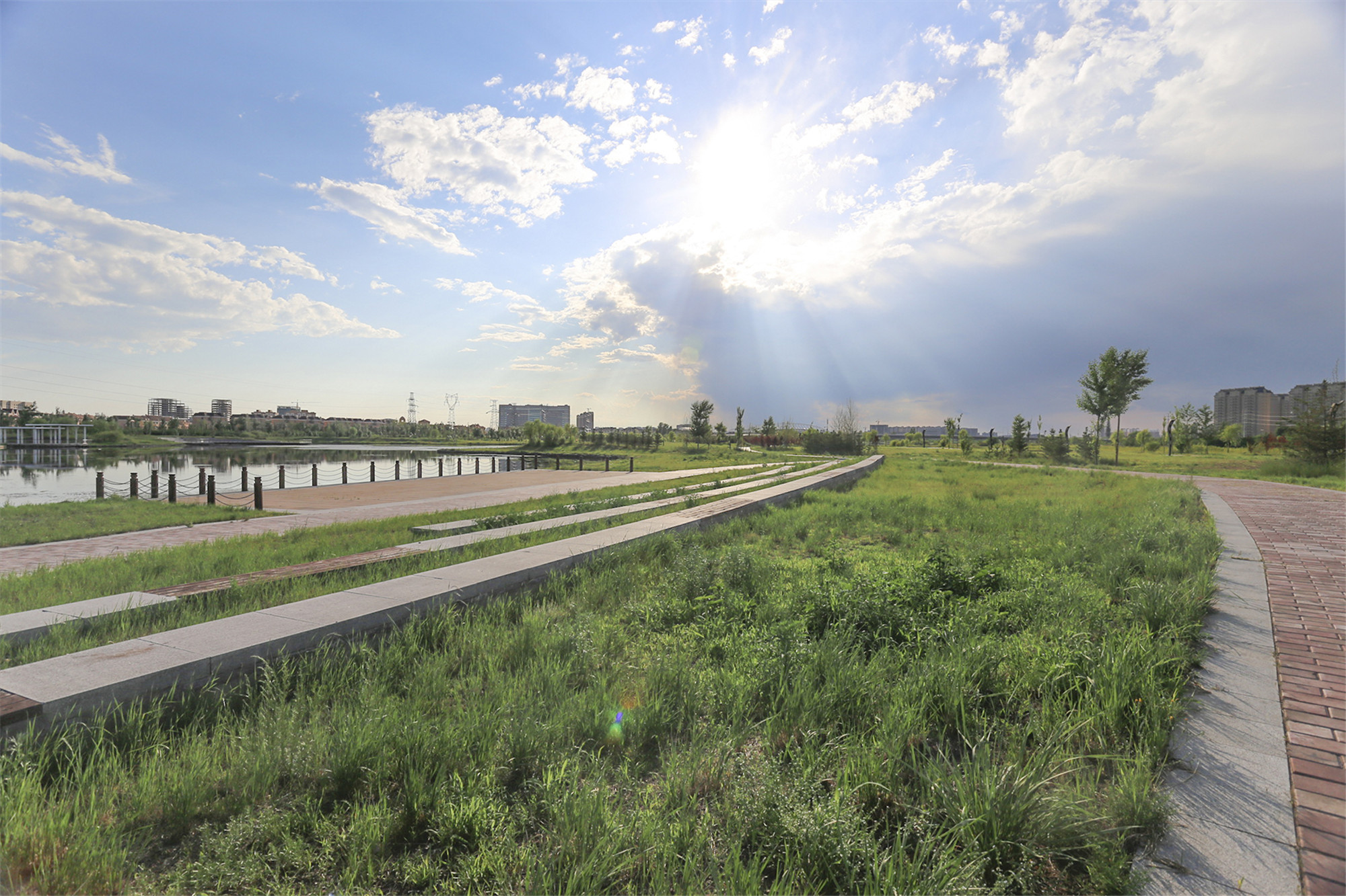
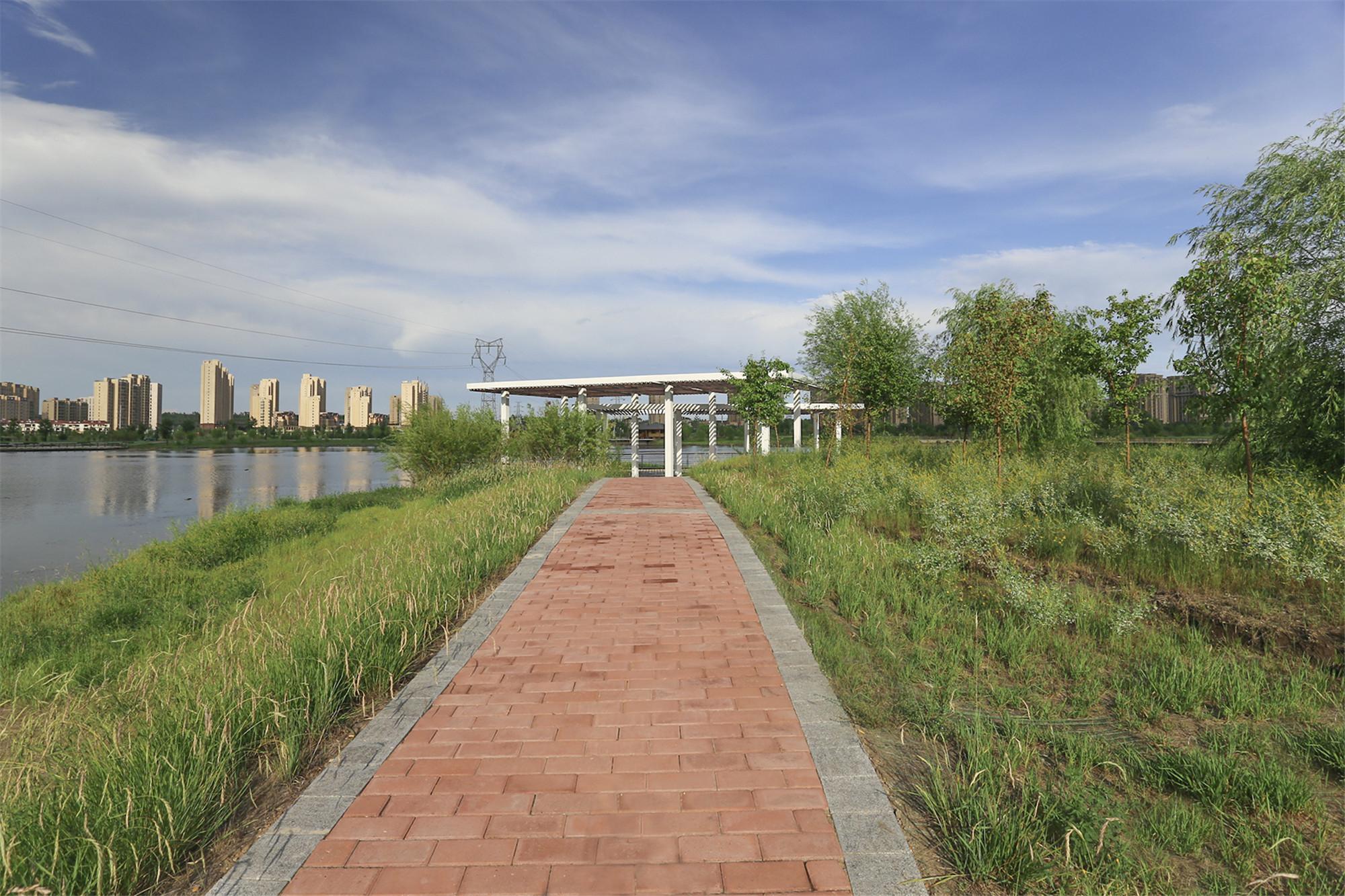
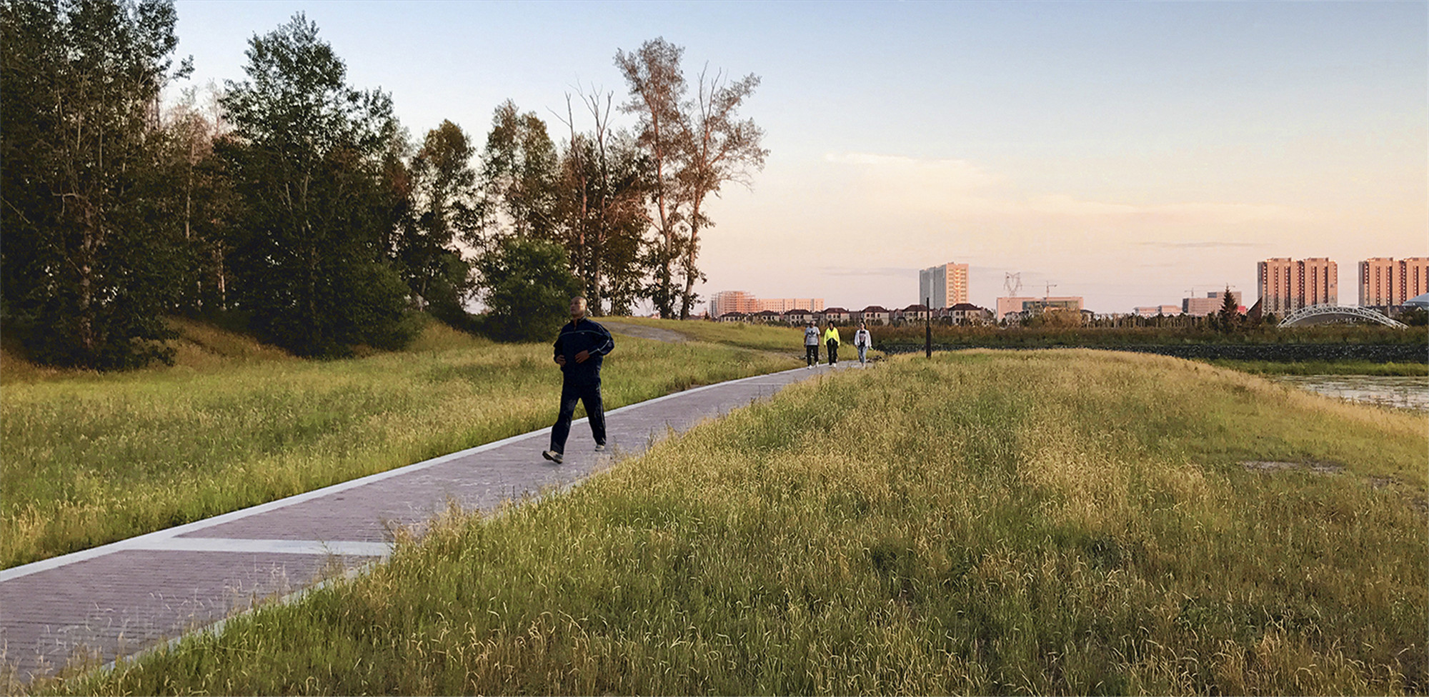
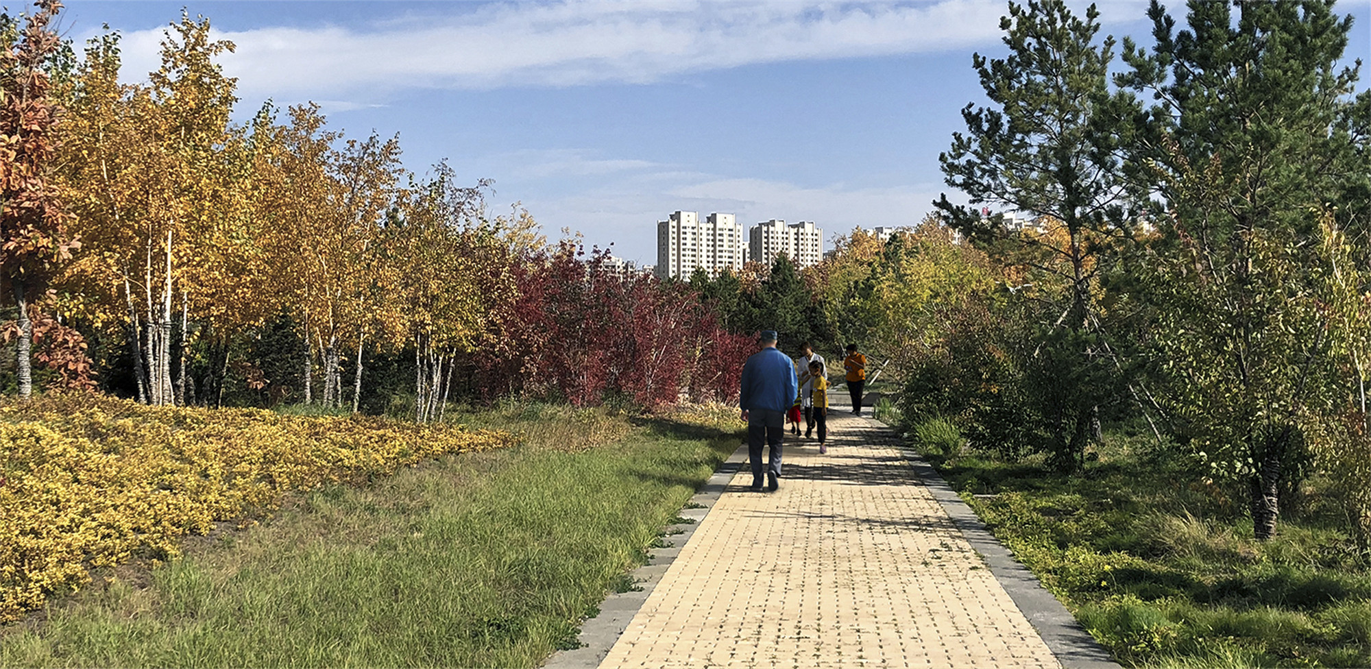
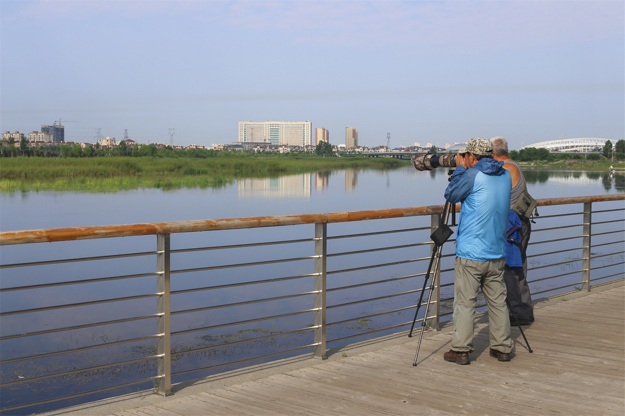
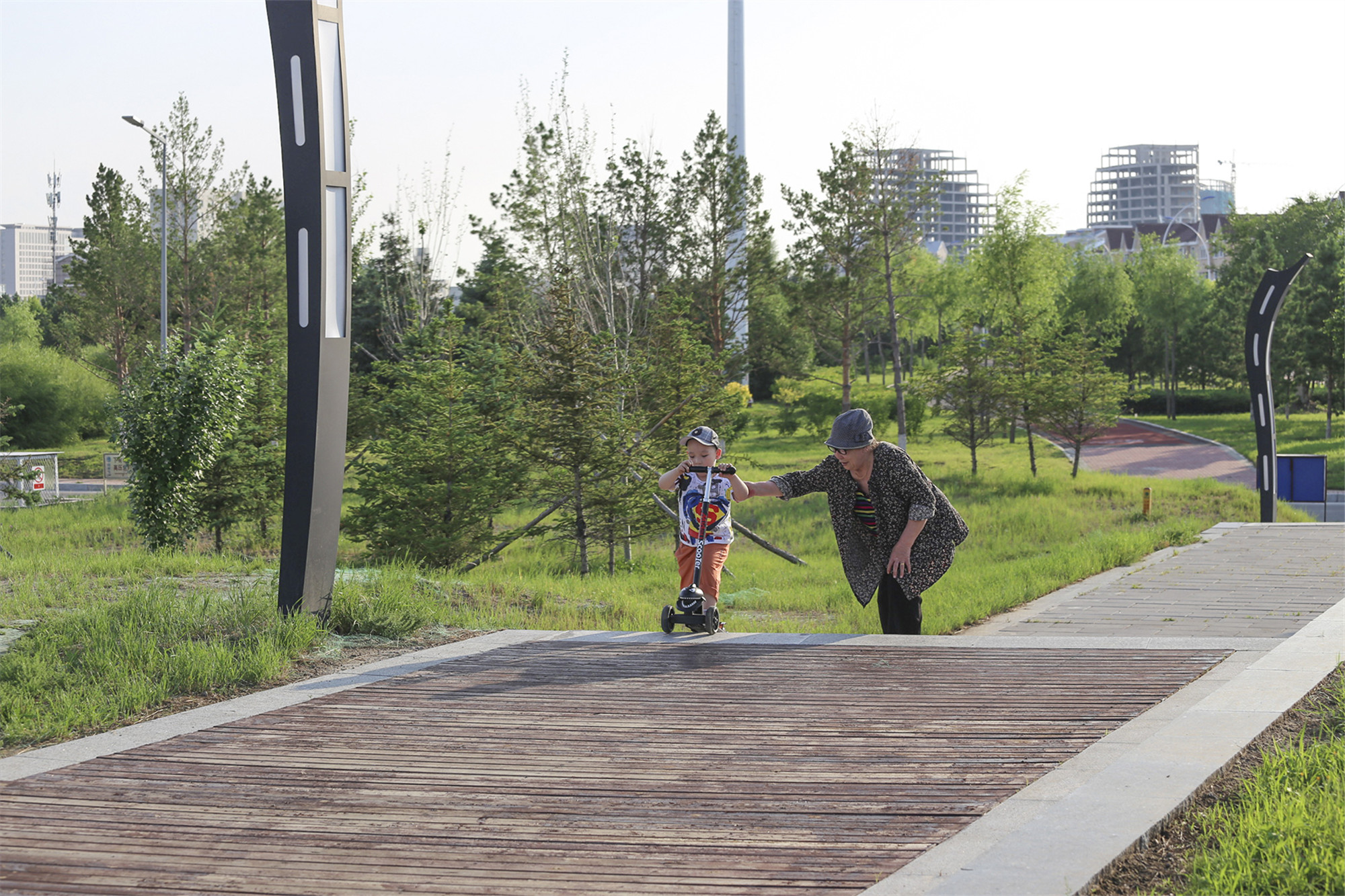
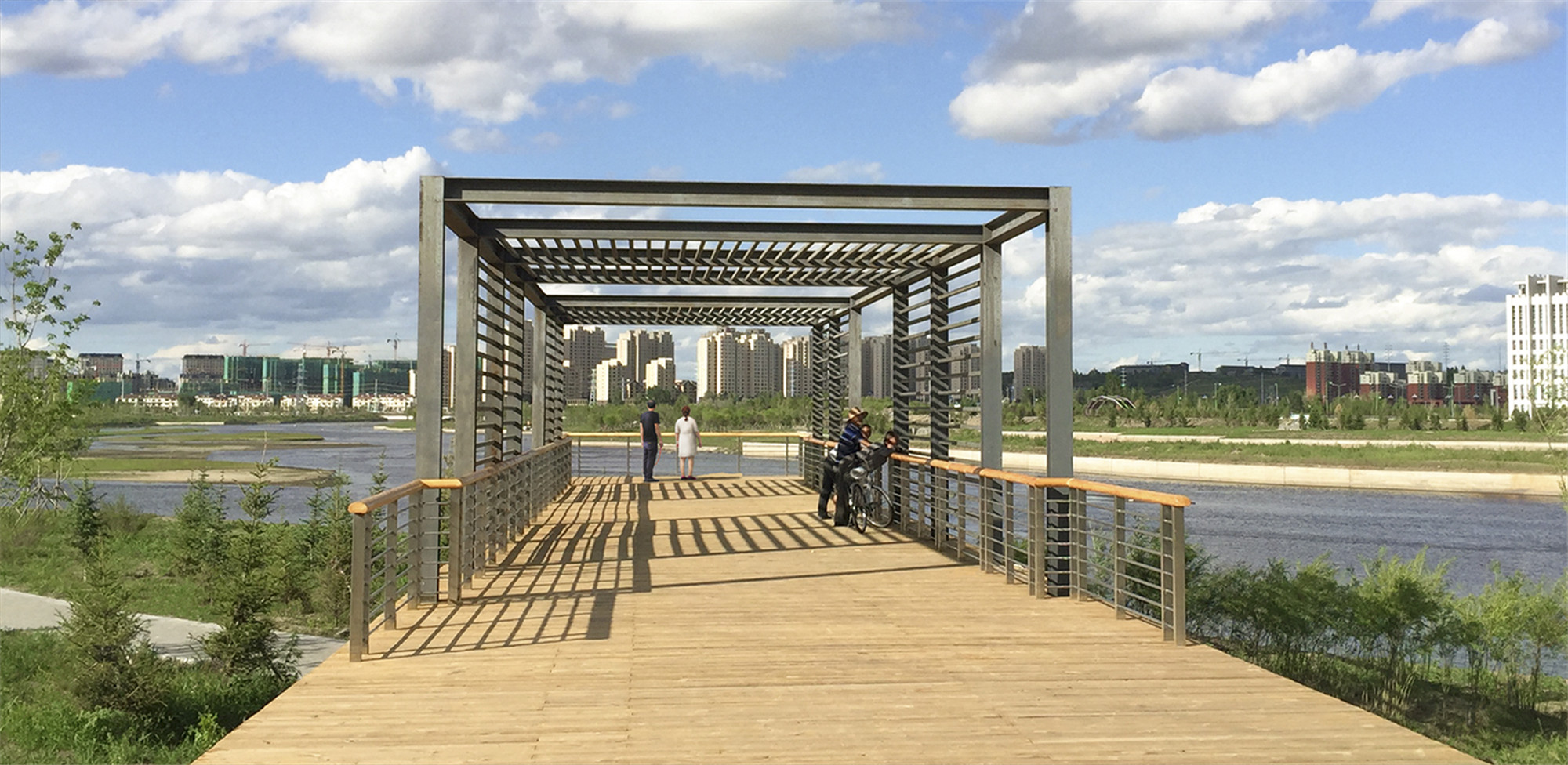
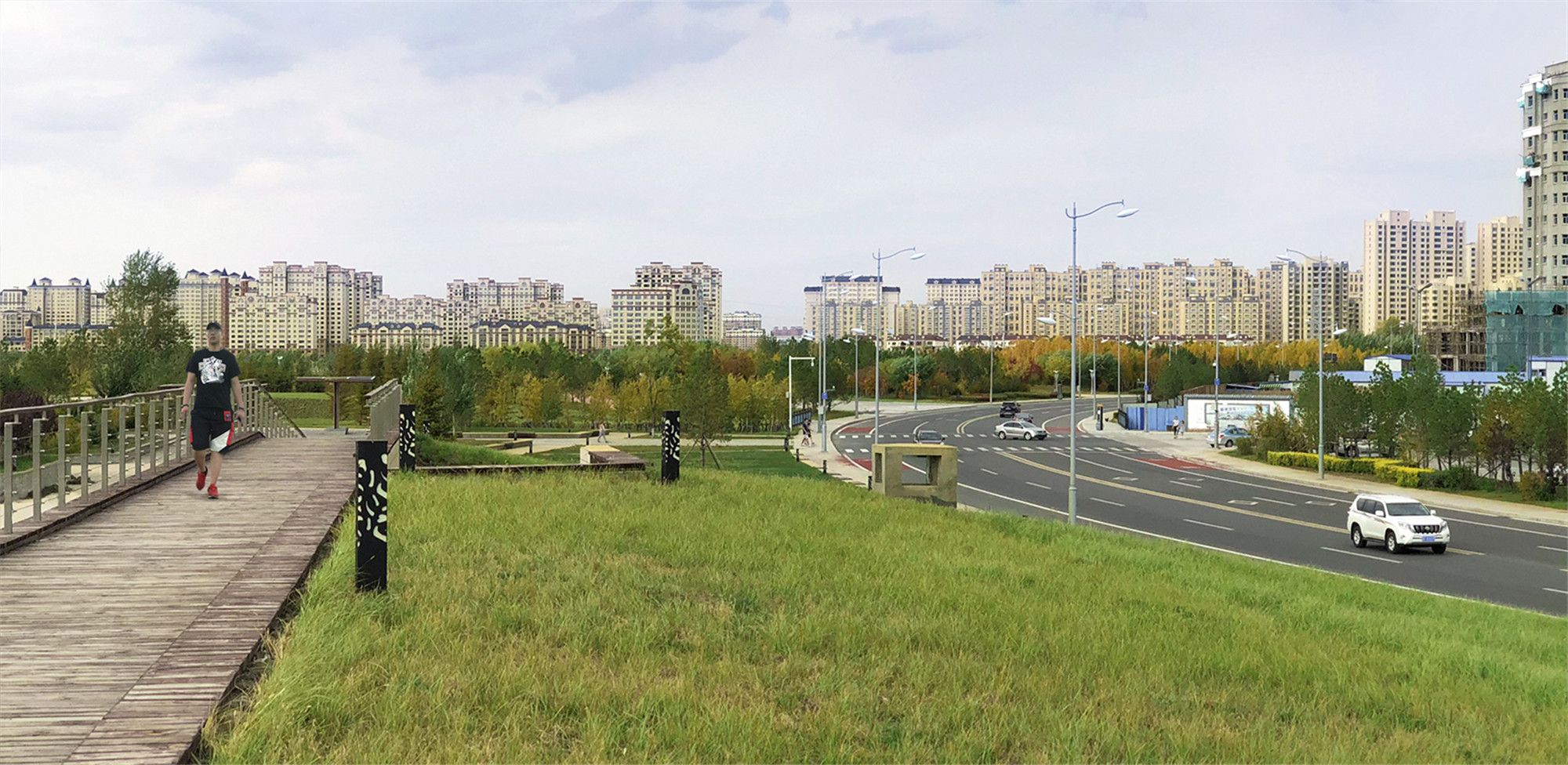
设计在对滩地进行植被恢复的同时,沿主河道贯通了一条宽为5米的游步道,成为沿河社会居民健身运动的好去处。该步道采用了本地特色的透水砖,能经受洪水的长时间浸泡考验。沿着游步道,设计师在广阔的滩地上依次设置了各种球类运动场、休闲草坪、户外剧场、健身驿站,以及观鸟平台等,为周边市民提供了一个运动休闲与亲近河流的机会。
After the vegetation has been recoved, a six-meter walkway along the river was established for exercises of the riverside residents. The pavement brick was particularly selected from the local materials, designed for enduring long time flood soaking. Along the walkway, a variety of informal outdoor places like sports field, leisure lawn, amphitheater, playground, and bird watching platforms are lined up, providing an opportunity for the riverside people to enjoy the river.

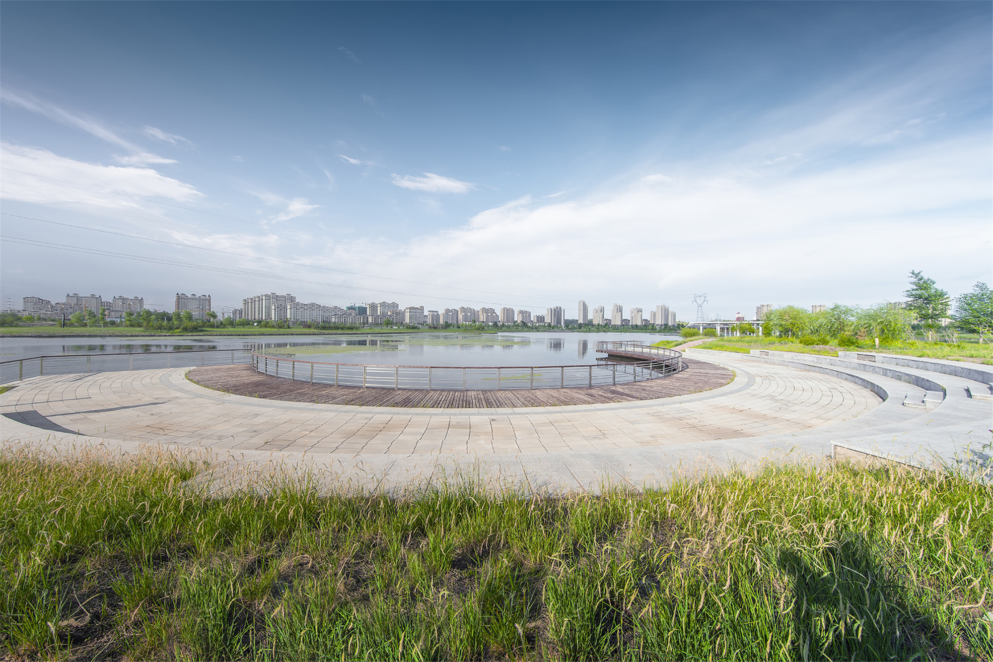
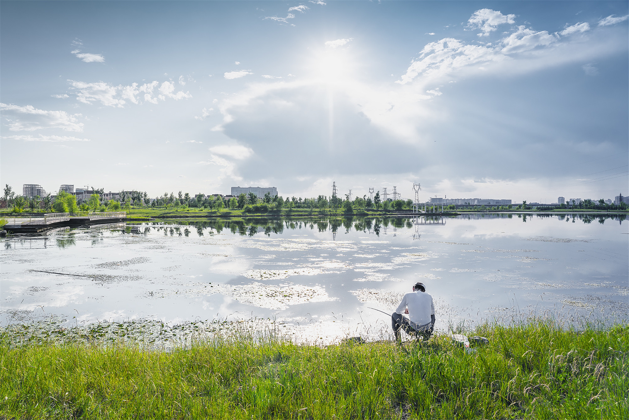
在河道转弯的滩地区,形成了一个面积为7公顷的泻湖。一方面,泻湖提升了季节性过洪所需要的泄洪场地;另一方面,作为日常稳定水面的湖体,泻湖周边区域已成为见识鸟类栖息及市民悠闲垂钓的场所。目前泻湖周边的植被已经恢复,并因市民郊游、观鸟、摄影等活动而广受欢迎。
In the river turning area, a lagoon of 7 hectares has been created, to enhance the flood discharge capacity in flood season. Meanwhile, After the vegetation has been restored, the lagoon area has become a popular destination for passive leisure activities like bird watching, meditating, fishing, and photographing.


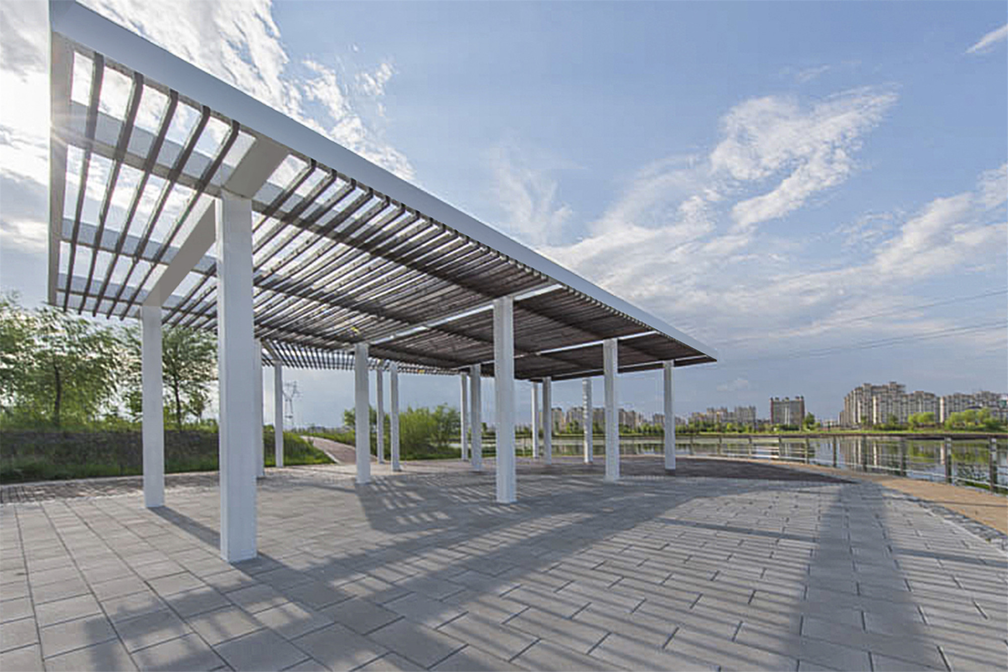
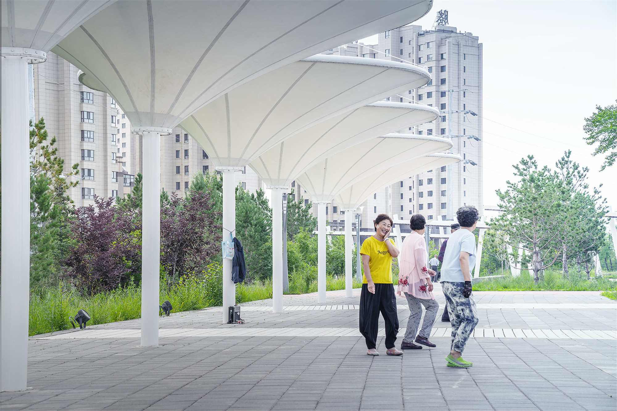
堤上公园的活力聚集
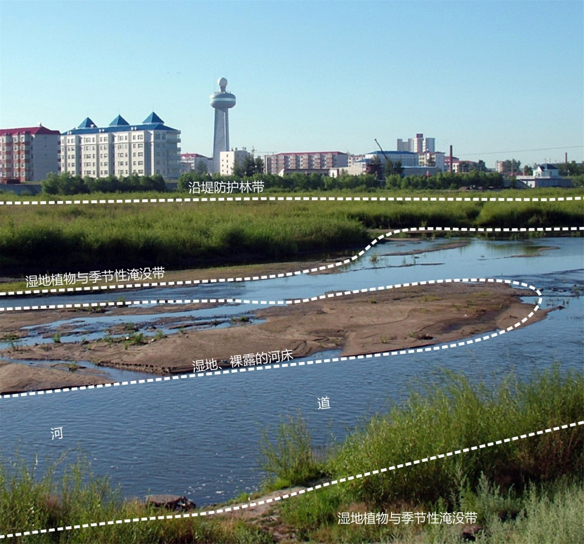
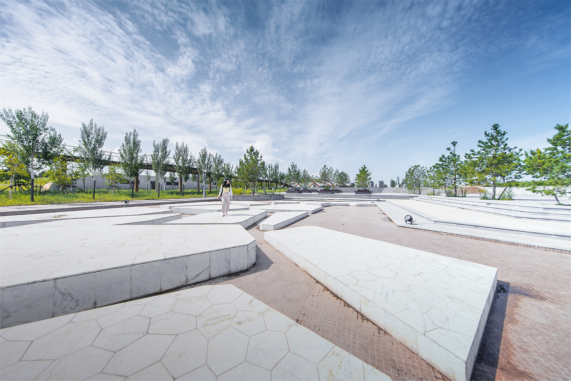
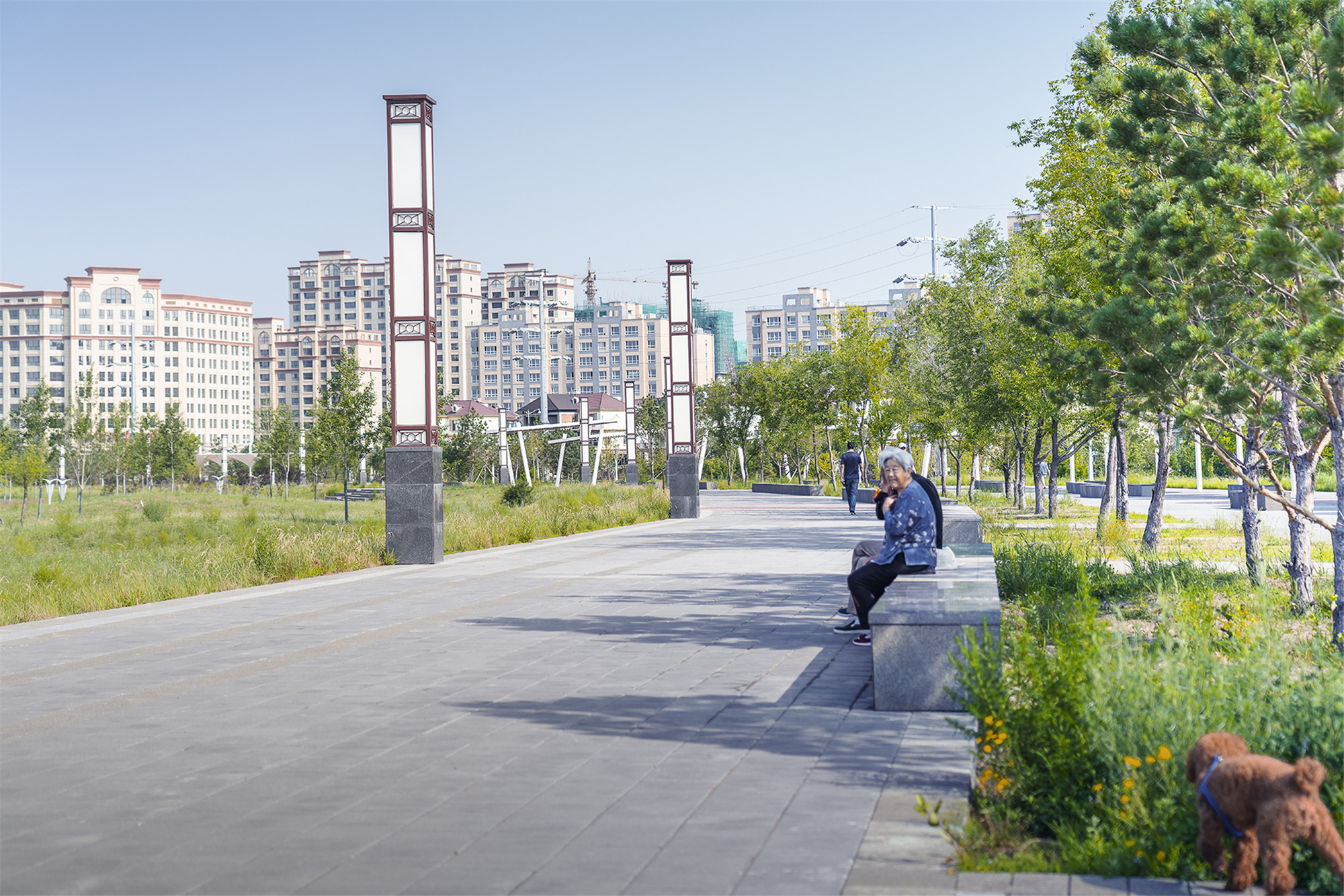
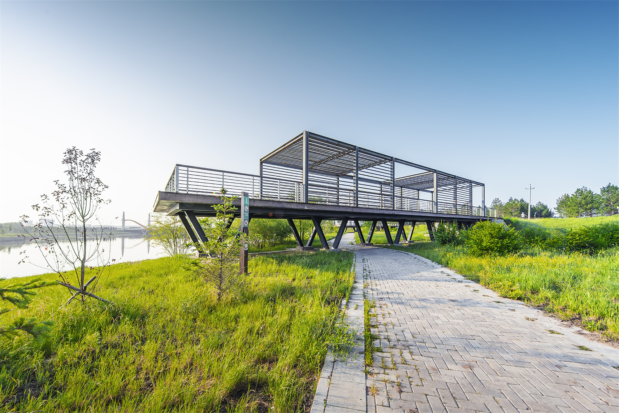
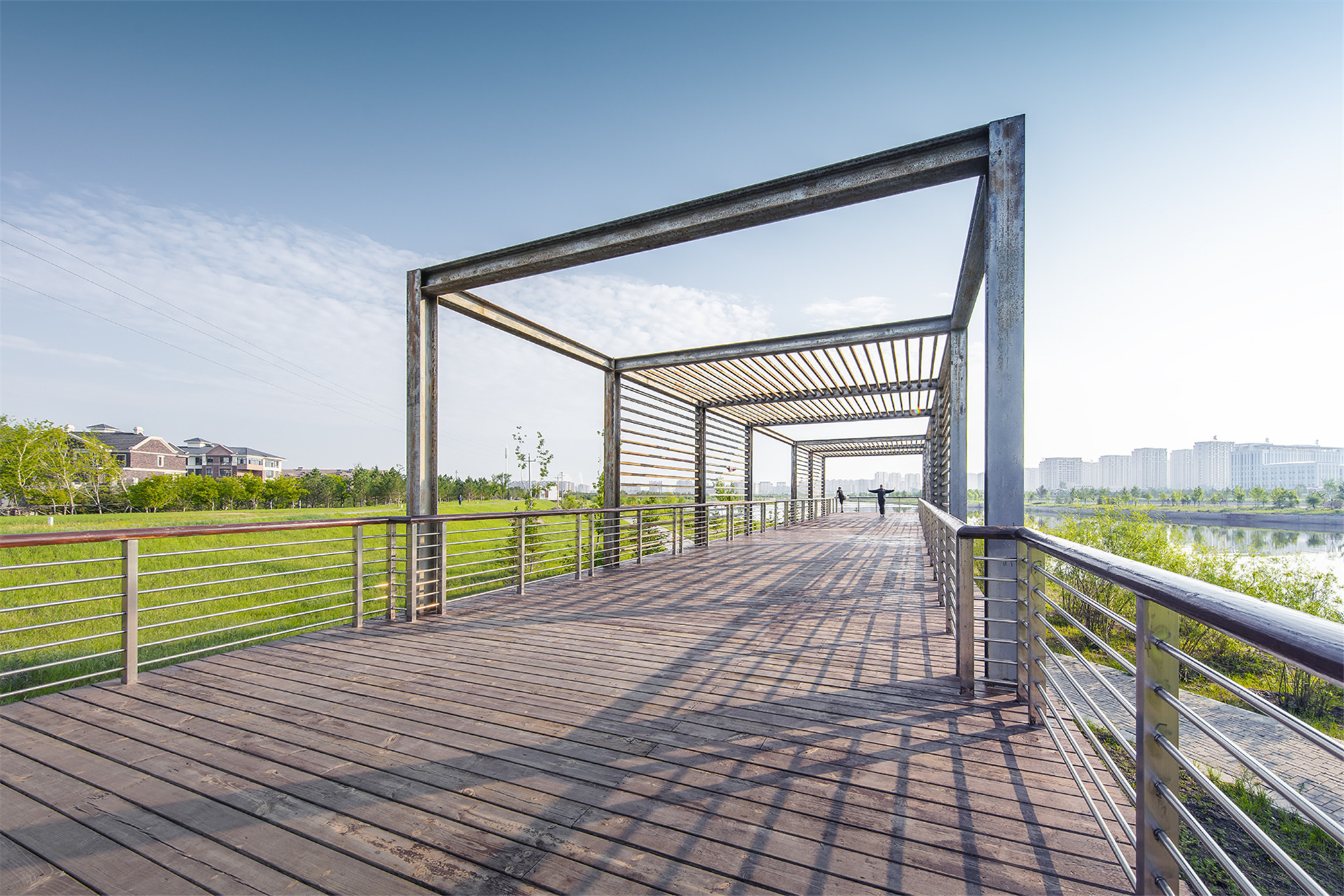
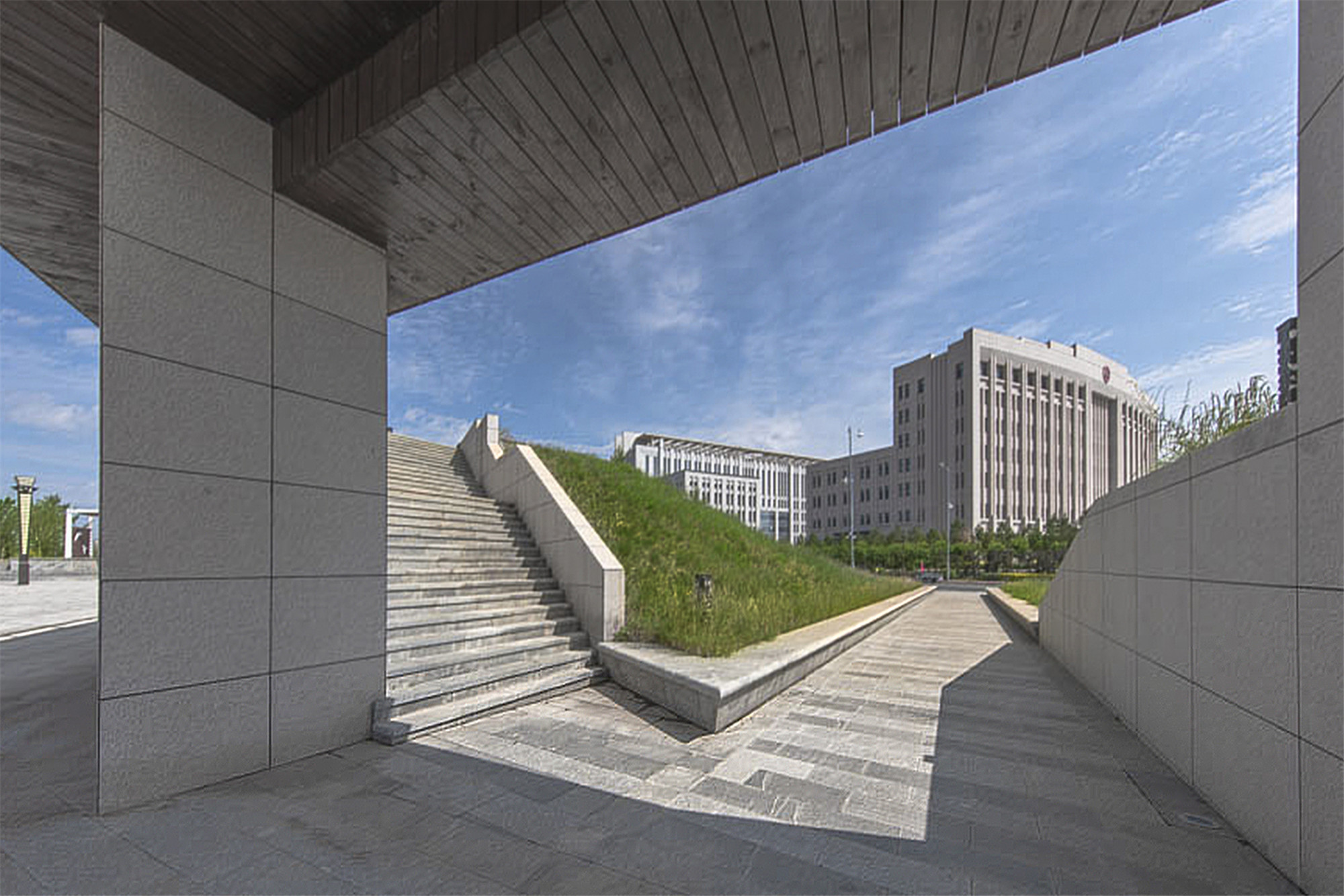
堤上公园带是不会受到洪水侵扰的城市公园区域,在这个线形的公园带中,承载着市民与游客游憩与观景的诉求。因此,一方面公园沿线通过本地乡土植物的搭配,形成了四季鲜明的植物观景带;另一方面设计也引入了文化体验广场、地标性的观景平台,以及配套的服务建筑等实现了公园活力的汇聚。
The green belt space above the levee is an urban park area that will meet the citizens and tourists’ intense sightseeing and recreational needs. Therefore, the levee park will have a distinctive botanic area with a collection of the local plantings. Meanwhile, cultural plazas, iconic viewing platforms and the service building have been designed as feature elements in the park.
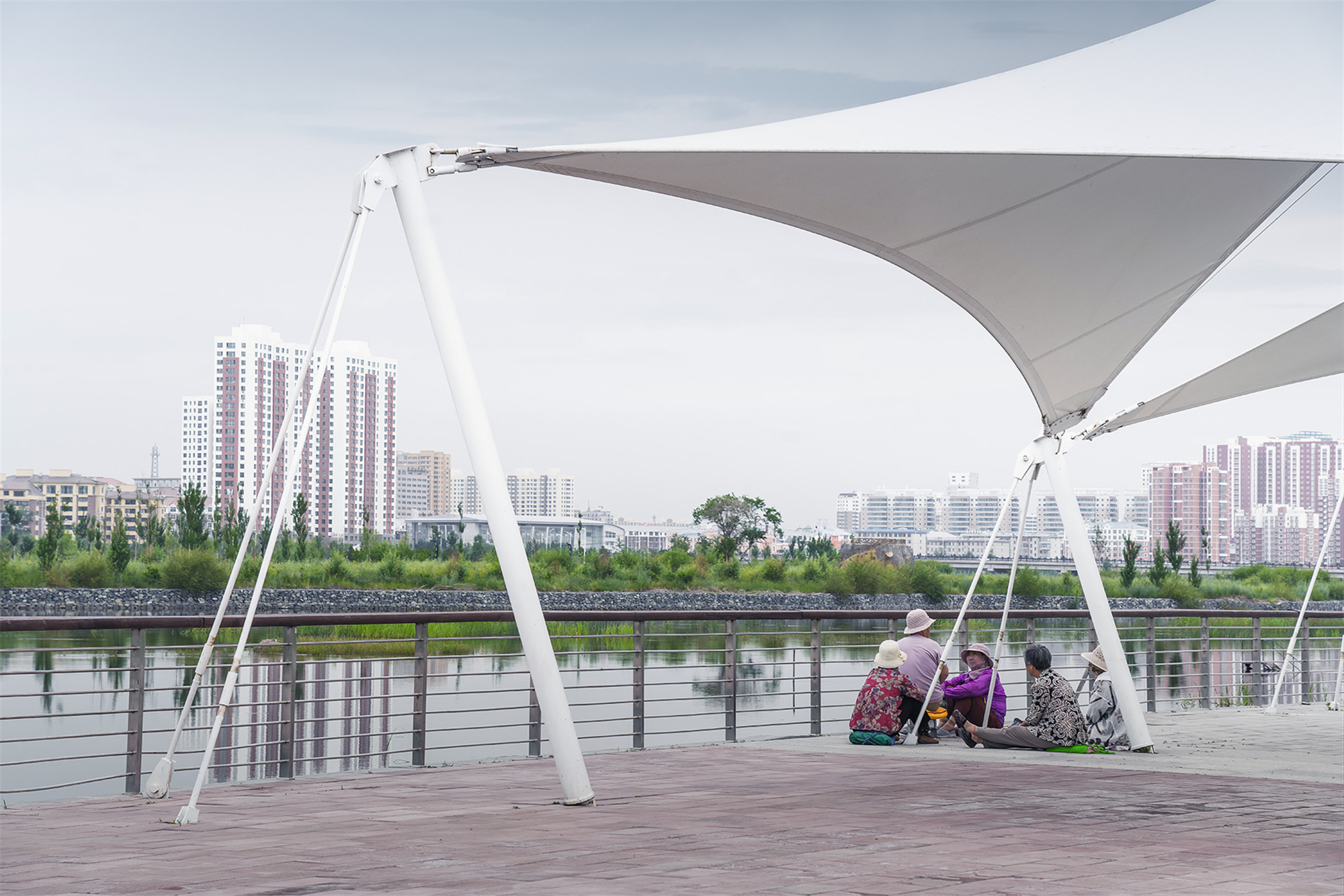
河堤公园带的植物采用了内蒙本地的植物种类,以形成季节性的群落式景观,供游人观赏的同时,也大大减少了草原强烈的季节风对游人的干扰。沿着带状植物观赏带,在堤坝旁形成若干外挑的眺望台,提供了一个观赏水流、滩地与湿地等辽阔景观的绝佳场所,成为城市的一个地标与名片。
The local plants, selected from the Mongolia forest, not only attract visitors to experience the colorful view in all seasons, but also greatly reduce the strong seasonal wind on the levee. Along the botanic belt, a couple of cantilevered lookouts are established along the embankment, providing a symbolic viewing deck for enjoying the grand landscape of the wandering waterflow, lush wetland. and vivid floodplain.
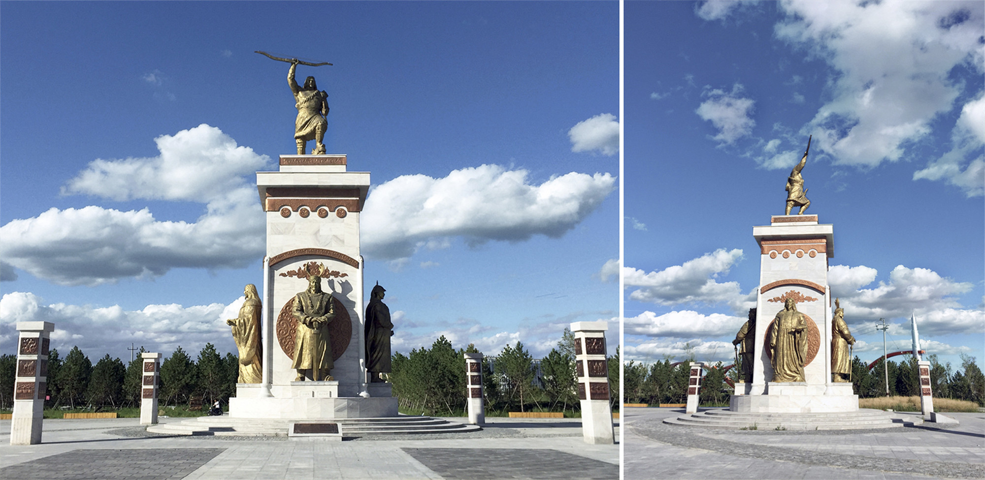
堤上公园带提供了两个有关蒙古历史和本地三少文化的主题广场,为市民与游客提供了教育与休闲的机会。每年夏天大量游客聚集的时刻,这两个文化雕塑广场作为重要的景点,成为外地游客学习与体验的重要场所。与广场结合的是模拟草原土丘的生态覆土建筑,该建筑为居民与游客的聚集,提供了必要的公园服务配套。以能源可持续的要求设立的生态覆土建筑,在提供游客所需的信息与购物服务的同时,也成为了一个沿河赏景的重要走廊。
Along the levee park belt, two cultural theme plazas are created to celebrate the rich Mongolian and local minority culture, which provide great leisure and educational opportunities for the visits. Every summer, this area has become one of the great attractions in the city. Alongside the plaza, a sustainable service building covered with grass is the dominant element, imitating from the natural mounds in the grassland. This earth covered building, designed to be energy efficiency due to the long cold winter, provides visitors with park information and necessary shopping and dining services.

项目总结
站在生态服务建筑顶的观景走廊看沿岸两岸,伊敏河河道蜿蜒而过,两岸绿意葱葱,这次设计实现了河道生态恢复韧性这一建设目标;而另一方面,沿河两岸的社区已经快速聚集,新城得以蓬勃发展。伊敏河公园自2018年建成以来,成功地实现了生态、经济、社会的多重目标。
Looking out from the viewing deck on the top of the earth covered service building, we see two different landscapes. At the riverside, Yimin river wanders through the grand green floodplain, which realized the vision of building a resilient river, meeting both the ecological restoration and recreational needs. At the city side, the new communities along the park have been developed rapidly, leads to the new town booming. Yimin Waterfront Park has successfully achieved the goals of ecology, economy and society for the city since it was opened at 2018.


完整项目信息
项目名称:伊敏河滨水公园
项目类型:规划/景观
项目地点:内蒙古自治区呼伦贝尔市海拉尔区
设计单位:MYP迈柏
主创建筑师: 余畅、李丹丹、吴威、louie、张维锋
设计团队:李熠飞、董娜、刘玫、唐敏、任脊、王波、李晓聪、郁郁
业主:呼伦贝尔规划局
建成状态:建成
设计时间:2012年—2013年
建设时间:2014年—2018年
用地面积:258万平方米
摄影:魏巍
版权声明:本文由MYP迈柏授权发布,欢迎转发,禁止以有方编辑版本转载。
投稿邮箱:media@archiposition.com


上一篇:Mecanoo公布鹿特丹海洋中心方案,优雅水上螺旋
下一篇:2020德国混凝土建筑奖8个获奖作品一览